Europaweg, the final section of Walker’s Haute route, is an iconic two-day hike, which is both demanding and rewarding. Once up there you pretty much have awesome views all the way until Zermatt.
However, the section from Gasenried until Galenberg has been closed since 2019 due to damage on the path that made the section too dangerous and difficult to repair. This meant that we had to take a detour – a walk until Herbriggen and then a grueling climb to Galenberg – 1300m ascent! The hardest climb has been left for the end… 🙂 And it was indeed tough.
From St Niklaus, a flat path leads towards Herbriggen. We spotted a few amateur signs (laminated pieces of paper) about the Europaweg detour, but I suggest not rely only on them as some turns are not indicated. The sign situation got even worse when we passed Herbriggen and started climbing up and my guide maps.me app didn’t even show that there is a path.
Without a proper map, we had to rely on the few signs and logic (we should be going south-ish). It’s not like there were multiple paths to choose from, but because it wasn’t on any guiding app we were doubting what is a path in this section. I know, I know, I sound like a city girl that relies on apps telling where to go… I do, ok?
Anyway, we did not get lost and just kept on climbing. And climbing. And climbing. After we left the tree line, we climbed with awesome views and it felt as if the top should be close. Yeah, right. Without the app recognizing the path (there she goes again) we didn’t know how much is left, we only knew our current altitude and the altitude at the destination, so that’s how we assessed our progress.
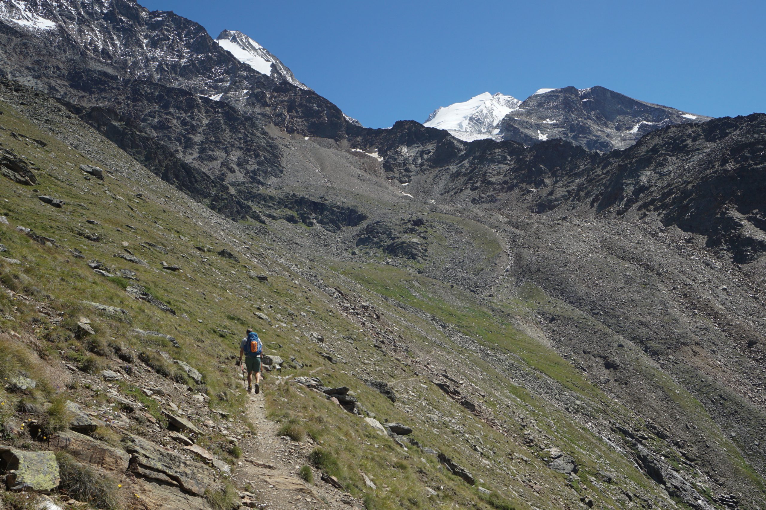
We’re on the famous Europaweg
Getting some views, while still not even half-way climbing
It looks almost as a vertical drop behind Edo. Well, it felt like a vertical climb
At around 2200m height (300-400m elevation left to gain) we both were pretty much done with this climb. Then a local senior passed us as if walking on flat land. Respect. We can do this as well.
And so at 13:00 (we started around 8:00) we made it to the top! And guess what, there was a bench with a table right below the top – best lunch place ever!
The glorious bench
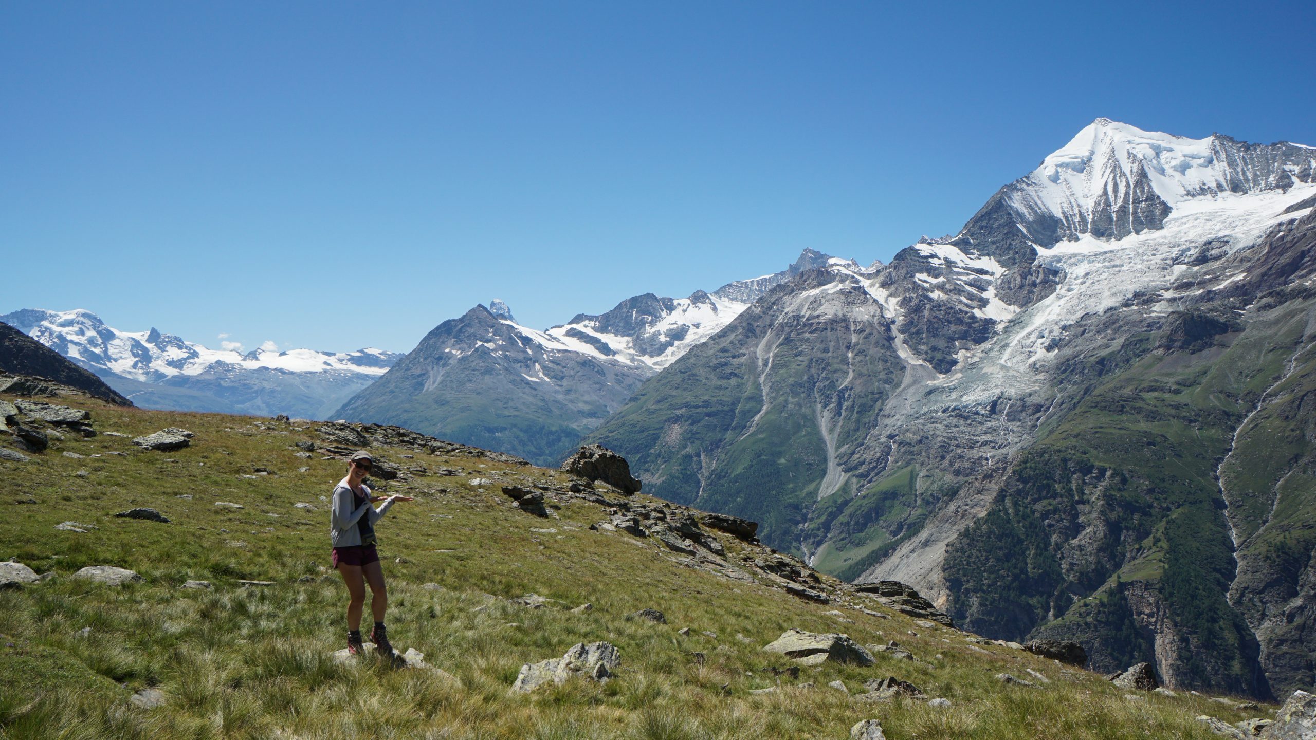
Weisshorn peak was in its full beauty while Mr. Matterhorn like some shy mountain goat was showing us just the peak, hiding behind the other mountains. From our lunch place, it was 1,5h until the hut and mostly on the same elevation level, jeeey! We finally could relax a bit and enjoy the rest of the hike.
I get why Europaweg is praised so much, it was a rough and fragile terrain with breathtaking views all around you. We had to cross a sketchy-looking (and moving) bridge, but besides that the path was fine. A lot of loose gravel on the sides of the mountains, probably that’s why this path is a total no-no when the weather turns sour. We had a hot sunny day, so perfect time to be at the top.
On fragile Europaweg. Scree and loose gravel dominated some of the sections
Towards Weisshorn
Europa Hut on the left, the hanging bridge on the right
We had the path to ourselves almost all the way till the hut, so when we started meeting small groups going the other direction, it was a sign that we’re close to our destination.
At around 15:30 we entered the hut, done for today! Jonas and Yves were already there, much faster than me with my ankle (yep, I still had to slow down, especially when descending). The rest of the evening we spent sitting outside the hut, enjoying the views and playing cards. Great location to finish the hike.
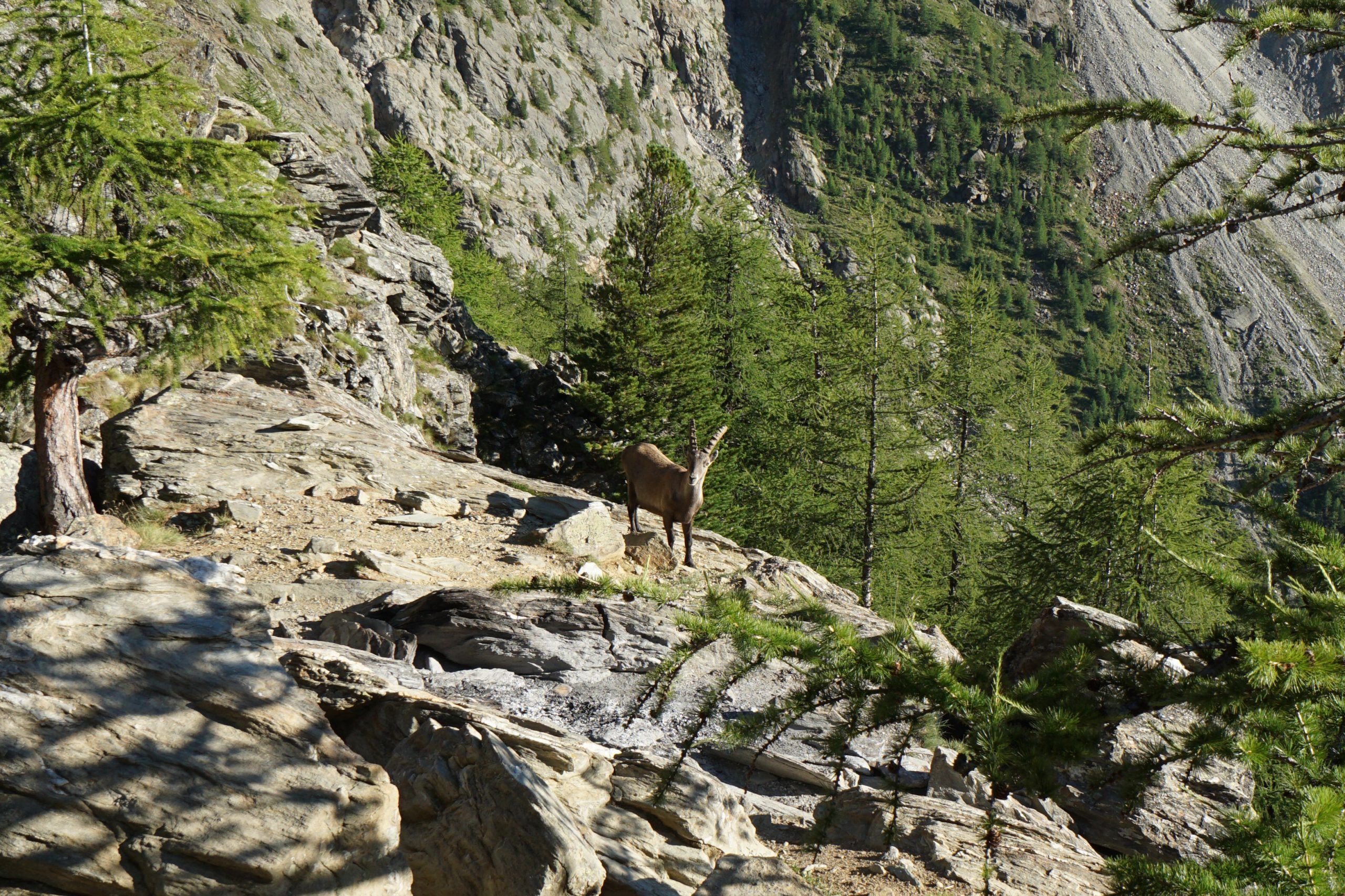
One of the locals came by to say hi
While I’m busy taking pictures, guys are already settling for a game and some drinks. Simona, didn’t you walk enough today?
Day 13 tips
You might want to have a decent physical map for the first hour after Herbriggen as it’s quite confusing where to go and signs are scarce (or at least were in 2020). Otherwise, just make sure that after Herbriggen in the forest you stick to the right. You’ll reach a stream, which you need to cross and then continue up from there. You will be ascending the whole time, otherwise it’s a wrong path.
Before going to Europaweg, check the official website of the path for latest developments. It’s a fragile landscape, you never know.
We use cookies on our website to give you the most relevant experience by remembering your preferences and repeat visits. By clicking “Accept”, you consent to the use of ALL the cookies.
This website uses cookies to improve your experience while you navigate through the website. Out of these, the cookies that are categorized as necessary are stored on your browser as they are essential for the working of basic functionalities of the website. We also use third-party cookies that help us analyze and understand how you use this website. These cookies will be stored in your browser only with your consent. You also have the option to opt-out of these cookies. But opting out of some of these cookies may affect your browsing experience.
Necessary cookies are absolutely essential for the website to function properly. These cookies ensure basic functionalities and security features of the website, anonymously.
Cookie
Duration
Description
cookielawinfo-checbox-analytics
11 months
This cookie is set by GDPR Cookie Consent plugin. The cookie is used to store the user consent for the cookies in the category "Analytics".
cookielawinfo-checbox-functional
11 months
The cookie is set by GDPR cookie consent to record the user consent for the cookies in the category "Functional".
cookielawinfo-checbox-others
11 months
This cookie is set by GDPR Cookie Consent plugin. The cookie is used to store the user consent for the cookies in the category "Other.
cookielawinfo-checkbox-necessary
11 months
This cookie is set by GDPR Cookie Consent plugin. The cookies is used to store the user consent for the cookies in the category "Necessary".
cookielawinfo-checkbox-performance
11 months
This cookie is set by GDPR Cookie Consent plugin. The cookie is used to store the user consent for the cookies in the category "Performance".
viewed_cookie_policy
11 months
The cookie is set by the GDPR Cookie Consent plugin and is used to store whether or not user has consented to the use of cookies. It does not store any personal data.
Functional cookies help to perform certain functionalities like sharing the content of the website on social media platforms, collect feedbacks, and other third-party features.
Performance cookies are used to understand and analyze the key performance indexes of the website which helps in delivering a better user experience for the visitors.
Analytical cookies are used to understand how visitors interact with the website. These cookies help provide information on metrics the number of visitors, bounce rate, traffic source, etc.
Advertisement cookies are used to provide visitors with relevant ads and marketing campaigns. These cookies track visitors across websites and collect information to provide customized ads.