Most of Kings Canyon’s beauty lies deeper in the wilderness. Initially, we wanted to hike Rae Lakes Loop, but unfortunately, we did not get the permits. So I was glad to find Mist Falls day hike, which offers pretty nice views of the Kings Canyon peaks, even if only for a day.
How to get there?
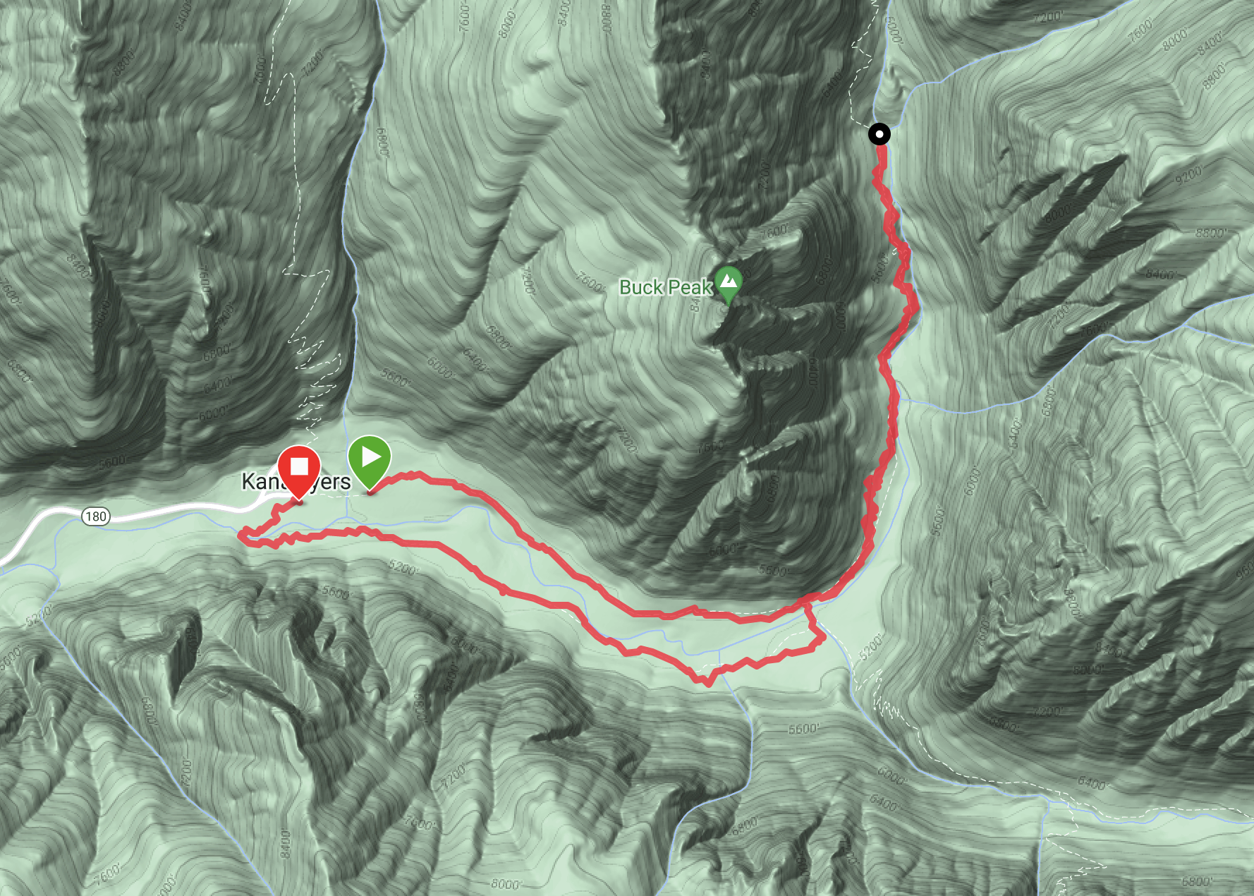
As far as I saw, there is only one way to get to the trail and it is by car. The closest village is Cedar Grove, from which you should follow road 180 until Road’s End, which is literally the end of this road 🙂 There are a few parking lots and we had no trouble parking our camper van. From the parking, we headed to the wilderness permit station, from which the trail starts.
So how was it?
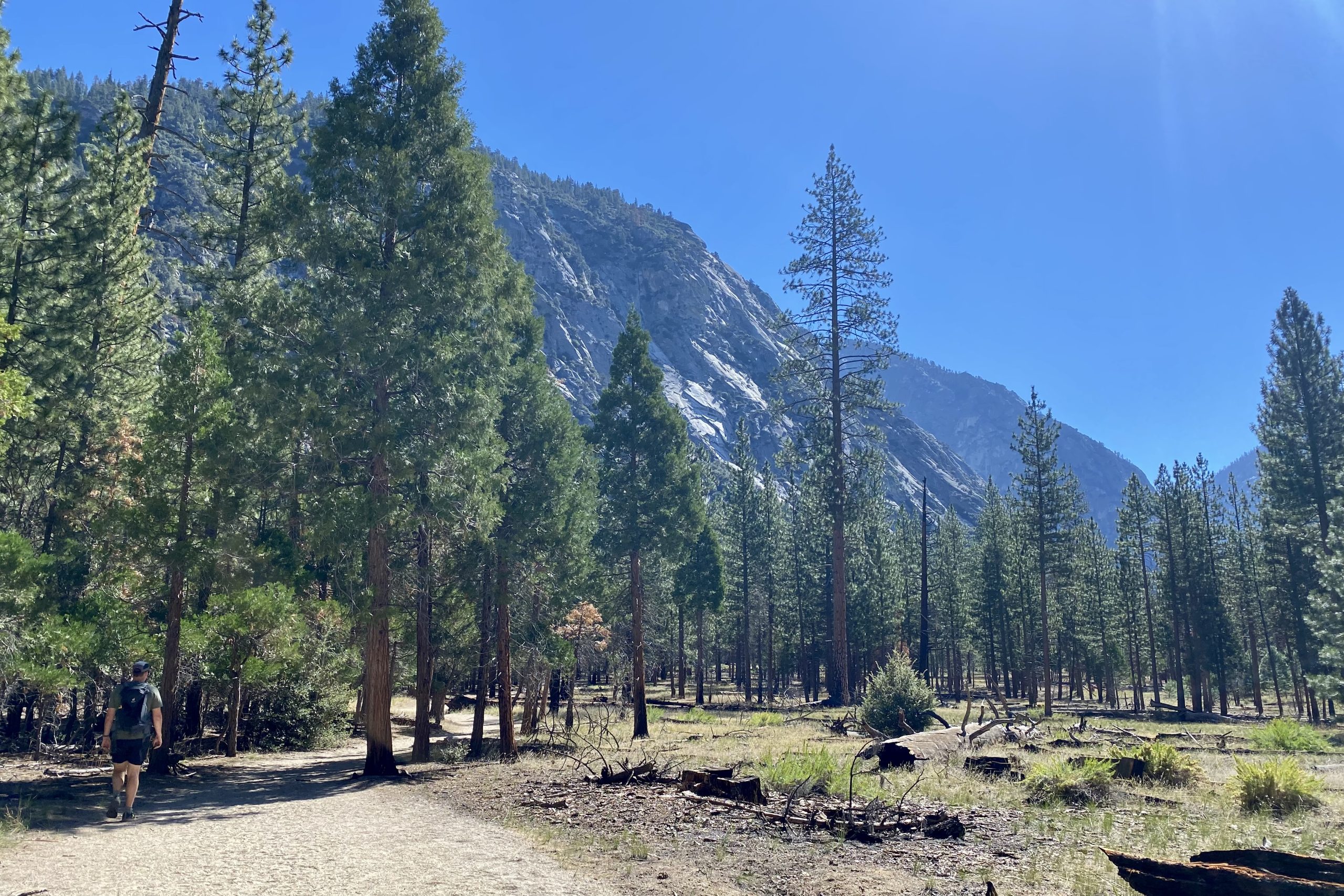
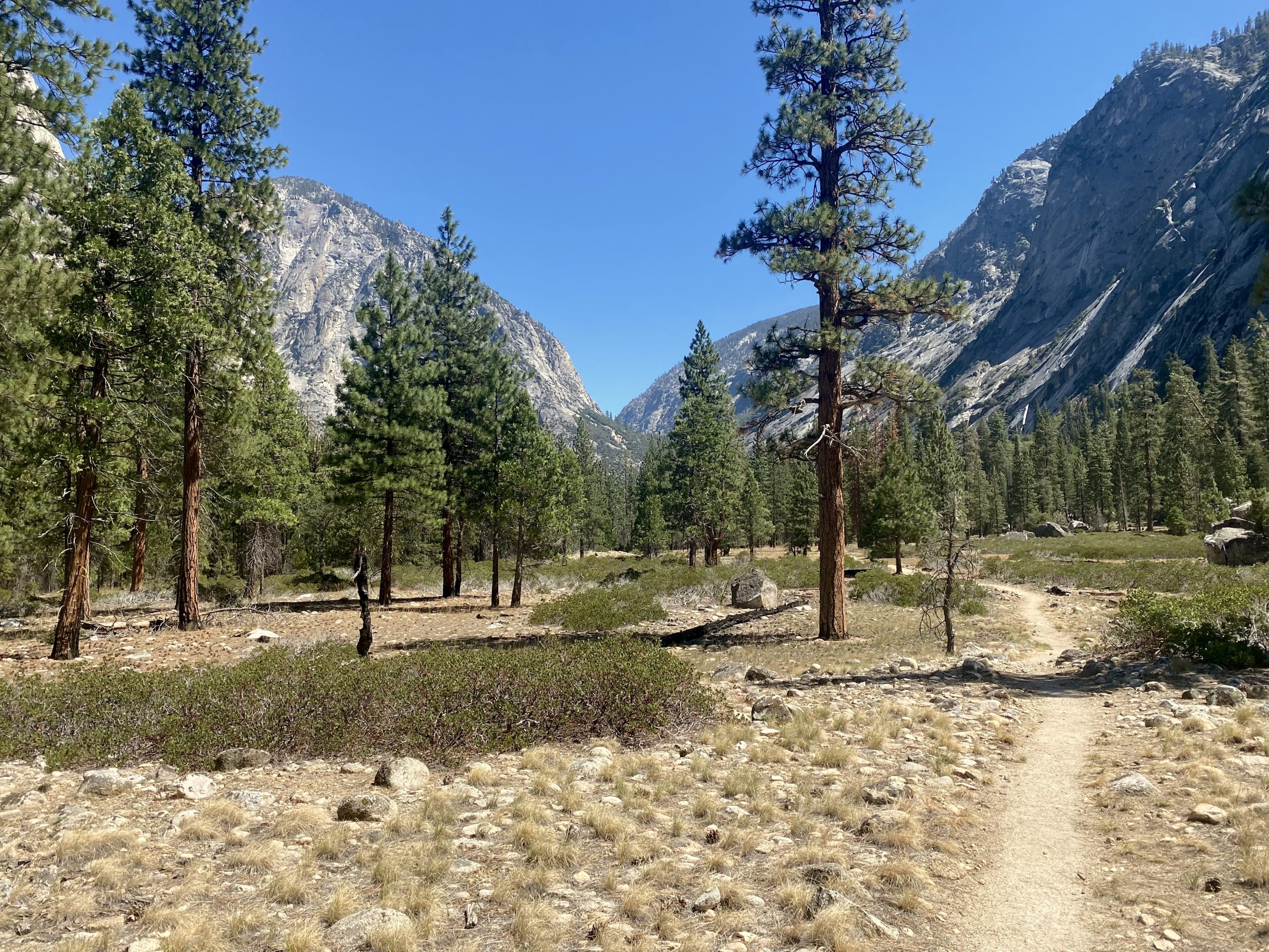
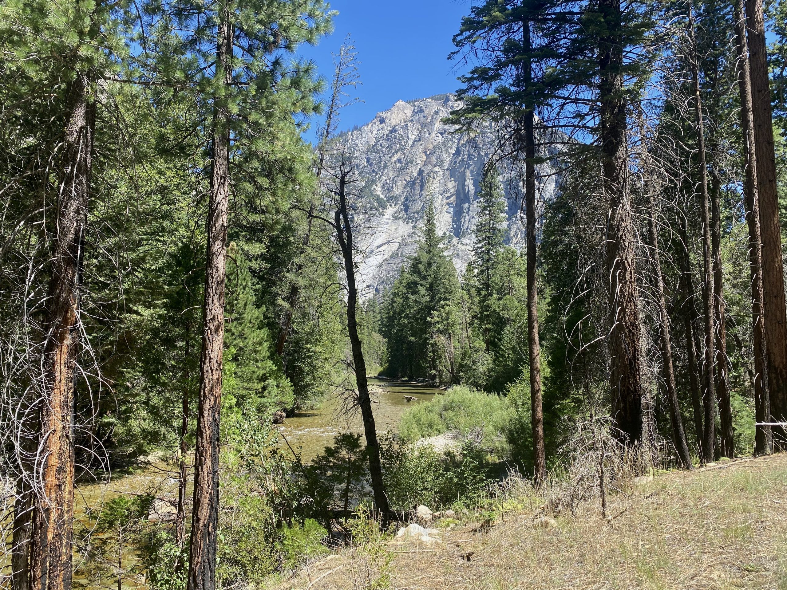
The trail began with a flat shaded walk, which was highly appreciated in more than 30 degrees (Celsius) heat. This was our very first hike in the USA, so we had no idea what to expect. Since we were in a bear territory, I was hiking in a slightly alarmed mode, especially in areas with lots of boulders, and I had the urge to shout “hey bear” once in a while.
Here we go, hiking in the USA!
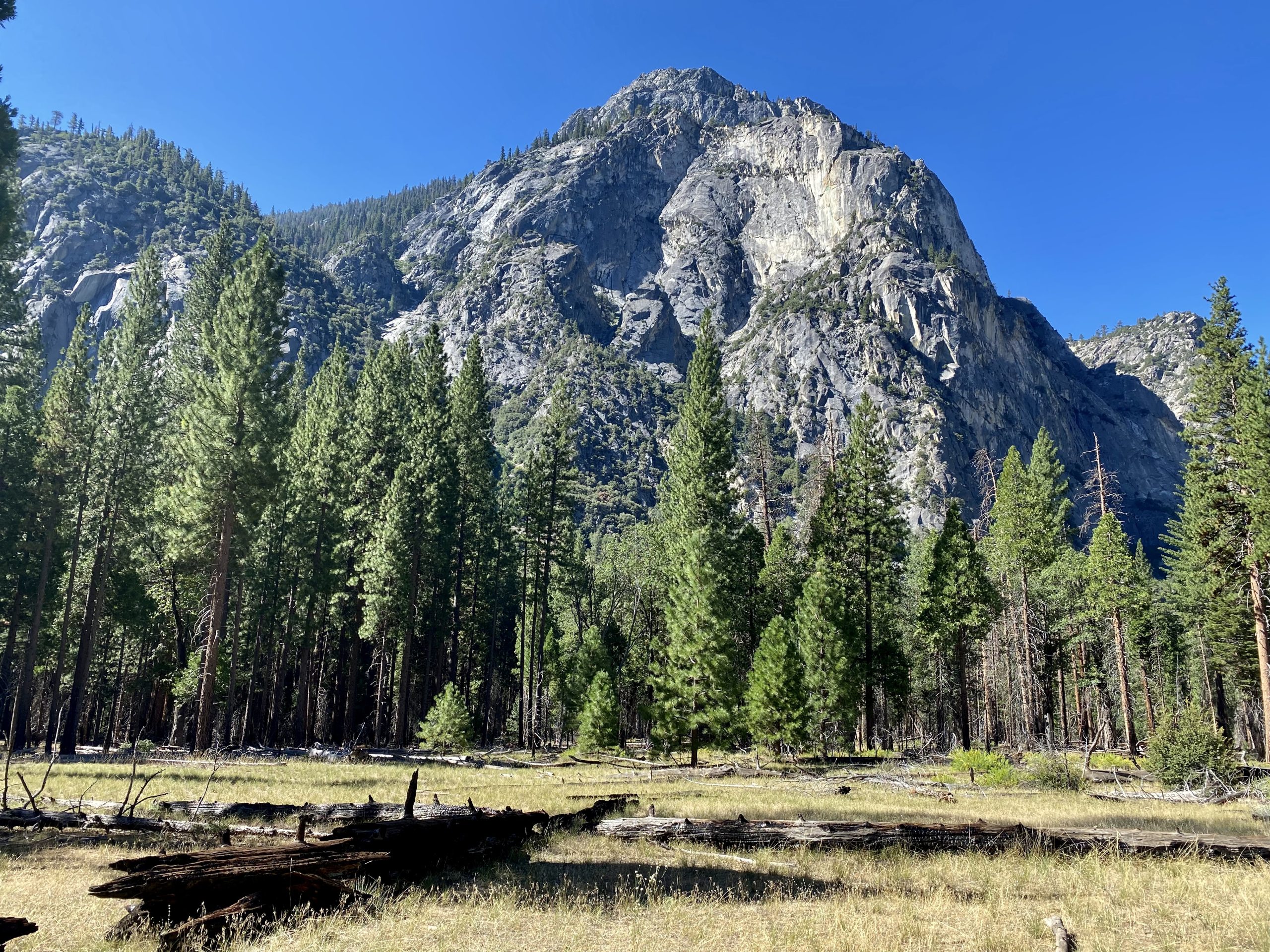
Magnificent rocks surrounding the meadow
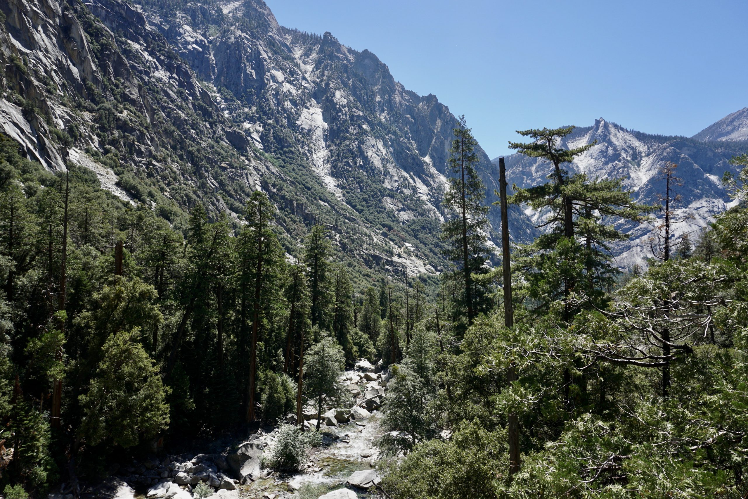
Kings river is probably at its lowest
The first half of the hike to the falls follows a forested trail alongside the river. Here the main challenge is to avoid all the bugs from flying in your mouth or eyes. They were damn annoying!
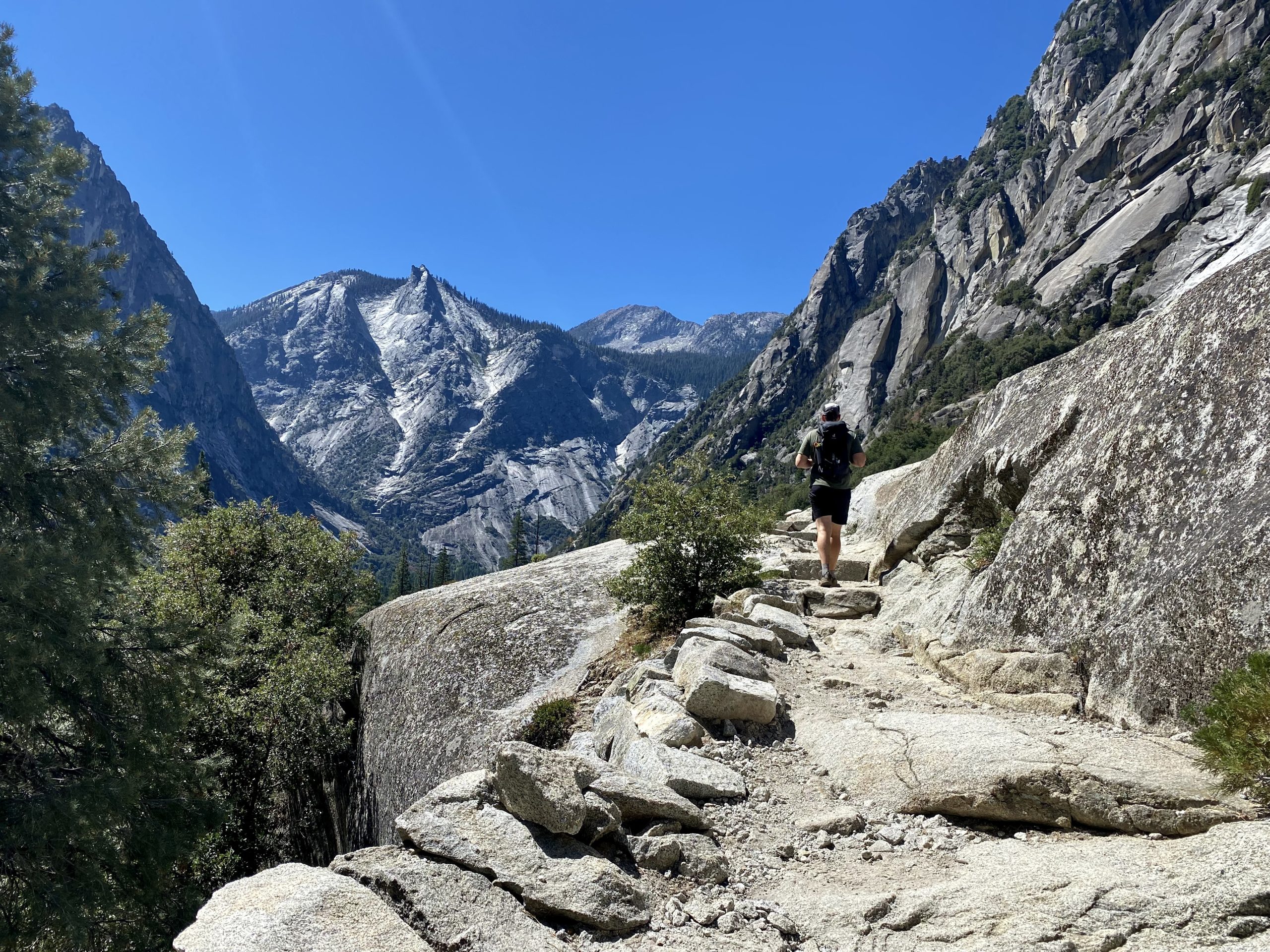
As we climbed higher, the views got better and the bugs finally left us alone. That also meant that we had less shade. Once in a while we’d come close to the roaring Kings river (either next to it or just above it). Since it was late August, the river was not crazy deep, but still crazy cold and fast 🙂
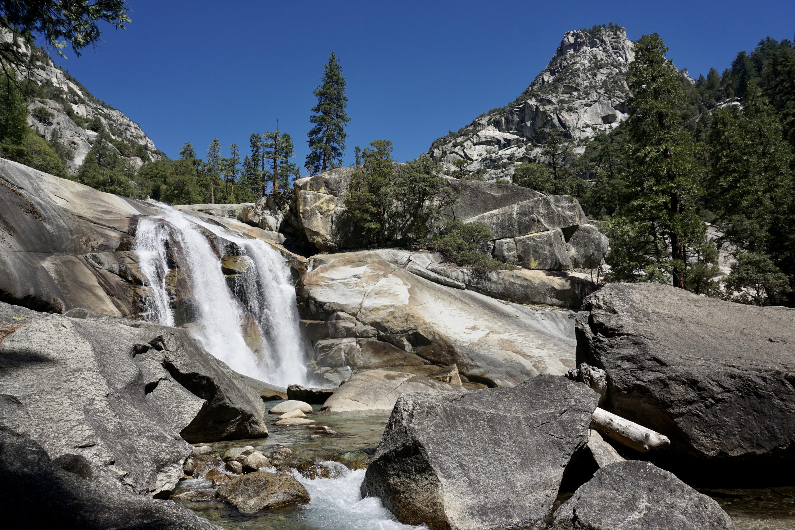
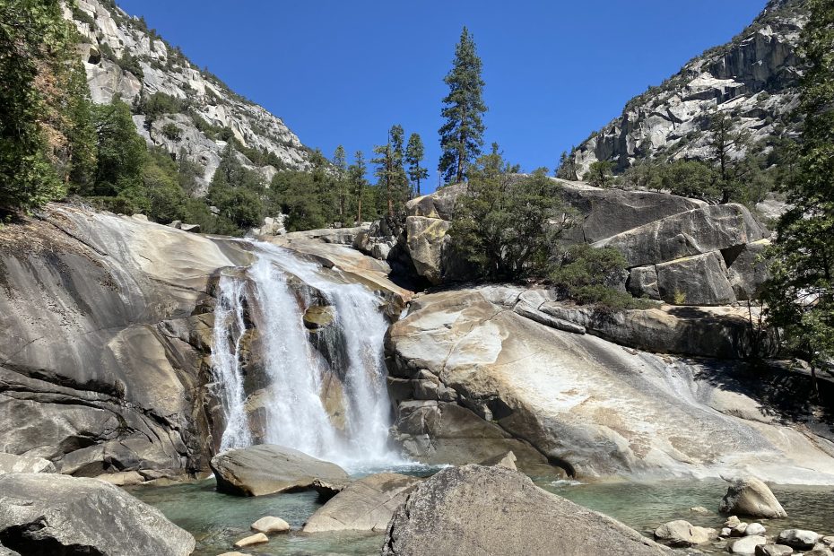
Once we reached the Mist Falls, there were still quite some rocks in a shade to hide from the scorching sun while enjoying the views of the falls.
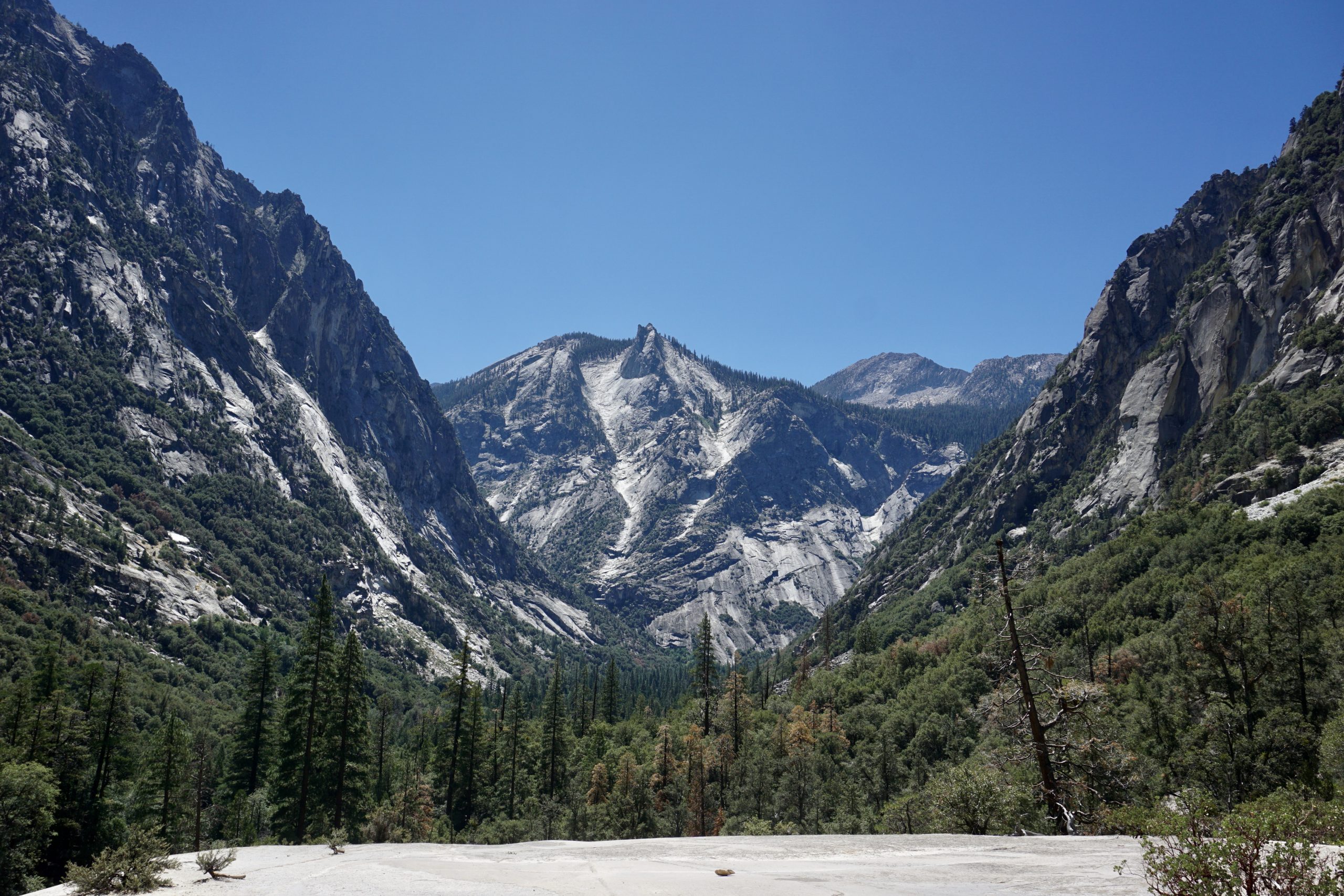
The views are clearing the higher we climb
My favourite view of the hike
The Mist Falls and the surroundings
After chilling at the Mist Falls, we came back the same way until the three-way junction where, instead of coming back to Road’s End, we crossed the river, followed Bubbs Creek trail for a bit until we reached Kanawyer Loop trail, and followed it to Road’s End.
This trail goes on the other side of Kings river and offers some nice views of the rocks around the trail since most of it is in a meadow. We did not meet anyone else on this trail, so it might also be a good alternative if you’re hiking during the peak days.
It is a bit longer route back, which finishes with a crossing Kings river again. We saw quite a few people swimming (or dipping) in the river, so that was also where we ended our hike.
Looking back at the open Kanawyer trail
Tips
If you have a bug net, bring it. It'll come in handy in forested areas.
Take plenty of water or water purifier as there are no facilities alongside the trail
We use cookies on our website to give you the most relevant experience by remembering your preferences and repeat visits. By clicking “Accept”, you consent to the use of ALL the cookies.
This website uses cookies to improve your experience while you navigate through the website. Out of these, the cookies that are categorized as necessary are stored on your browser as they are essential for the working of basic functionalities of the website. We also use third-party cookies that help us analyze and understand how you use this website. These cookies will be stored in your browser only with your consent. You also have the option to opt-out of these cookies. But opting out of some of these cookies may affect your browsing experience.
Necessary cookies are absolutely essential for the website to function properly. These cookies ensure basic functionalities and security features of the website, anonymously.
Cookie
Duration
Description
cookielawinfo-checbox-analytics
11 months
This cookie is set by GDPR Cookie Consent plugin. The cookie is used to store the user consent for the cookies in the category "Analytics".
cookielawinfo-checbox-functional
11 months
The cookie is set by GDPR cookie consent to record the user consent for the cookies in the category "Functional".
cookielawinfo-checbox-others
11 months
This cookie is set by GDPR Cookie Consent plugin. The cookie is used to store the user consent for the cookies in the category "Other.
cookielawinfo-checkbox-necessary
11 months
This cookie is set by GDPR Cookie Consent plugin. The cookies is used to store the user consent for the cookies in the category "Necessary".
cookielawinfo-checkbox-performance
11 months
This cookie is set by GDPR Cookie Consent plugin. The cookie is used to store the user consent for the cookies in the category "Performance".
viewed_cookie_policy
11 months
The cookie is set by the GDPR Cookie Consent plugin and is used to store whether or not user has consented to the use of cookies. It does not store any personal data.
Functional cookies help to perform certain functionalities like sharing the content of the website on social media platforms, collect feedbacks, and other third-party features.
Performance cookies are used to understand and analyze the key performance indexes of the website which helps in delivering a better user experience for the visitors.
Analytical cookies are used to understand how visitors interact with the website. These cookies help provide information on metrics the number of visitors, bounce rate, traffic source, etc.
Advertisement cookies are used to provide visitors with relevant ads and marketing campaigns. These cookies track visitors across websites and collect information to provide customized ads.