Skip to content

Mullerthal trail in Luxembourg: Routes 2 & 3

Distance (km)
0
Days on the trail
0
Castles spotted
0

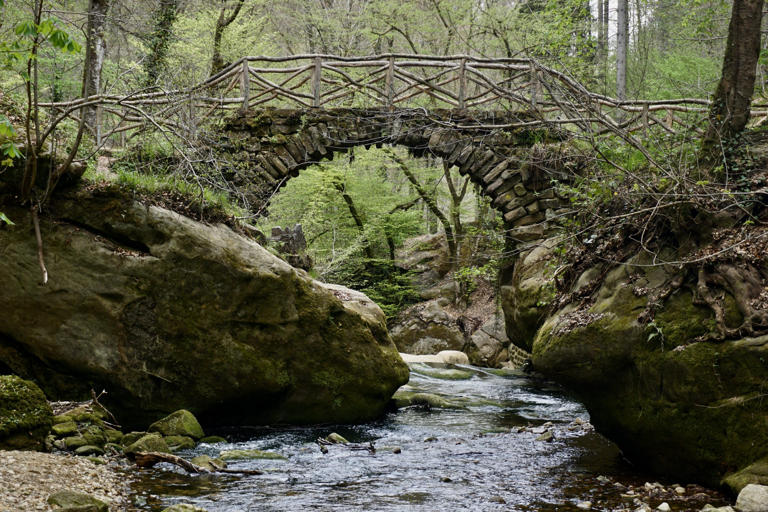
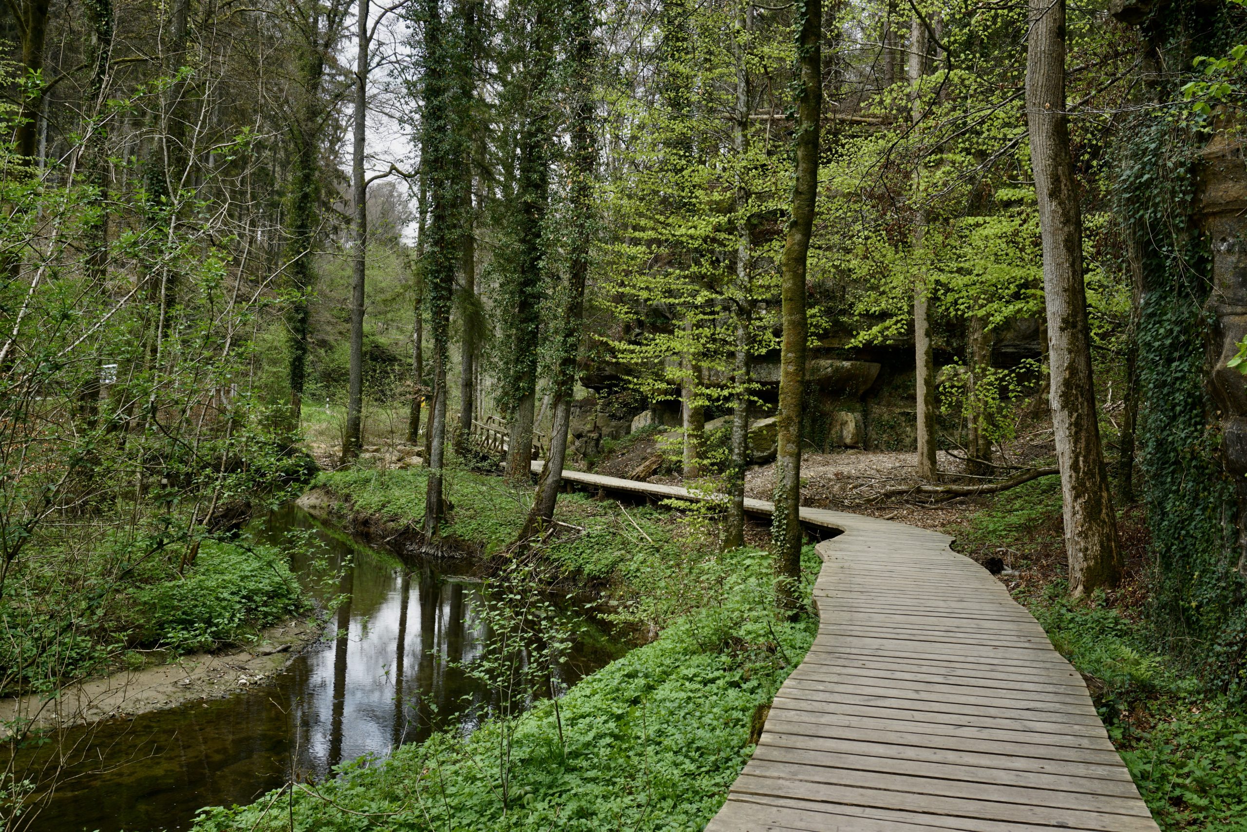
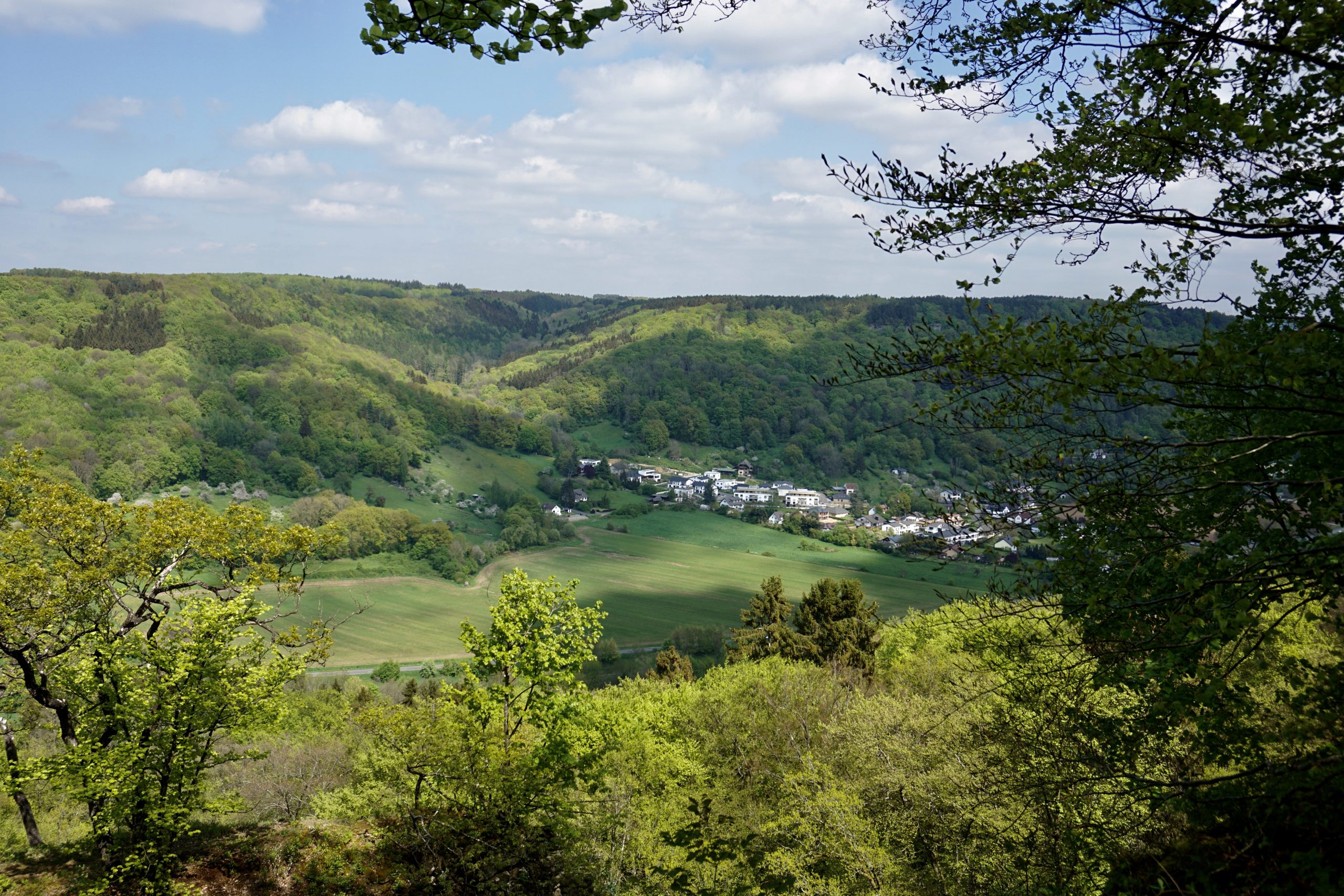
About Mullerthal trail: When looking for a hiking destination, Luxembourg doesn’t come into one’s mind easily. However, I’d say it’s a hidden European treasure for early spring and late autumn walks. While the big mountains will be covered in snow, Luxembourg trails will welcome you probably any time of the year.

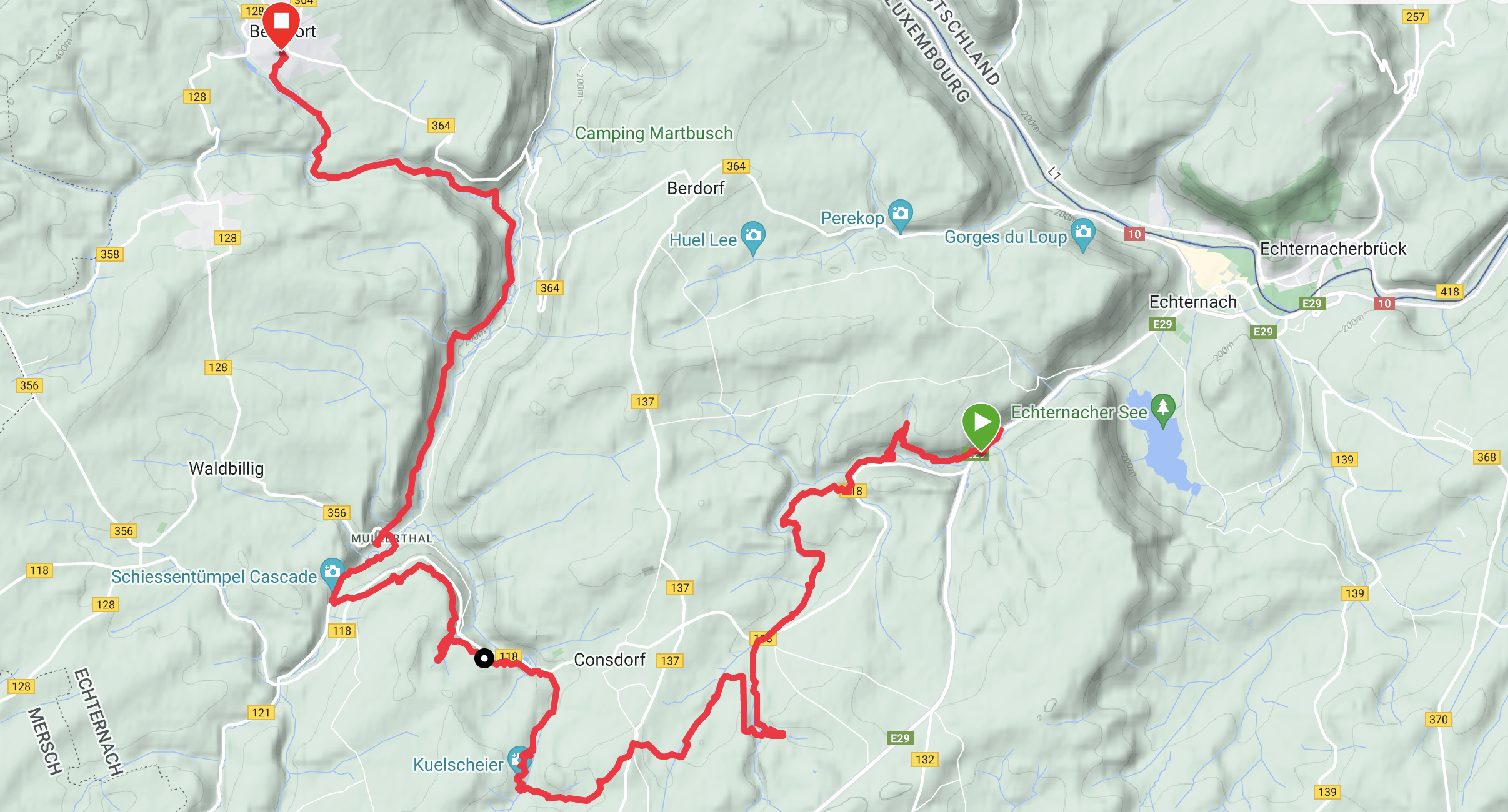
Mullerthal is one of the many (the most famous though) trails this little country has to offer. It’s 112km long and is divided into three circles or Routes. As the country is so proud of its trail, they even have an awesome Mullerthal website with a lot of info, so check it out. 

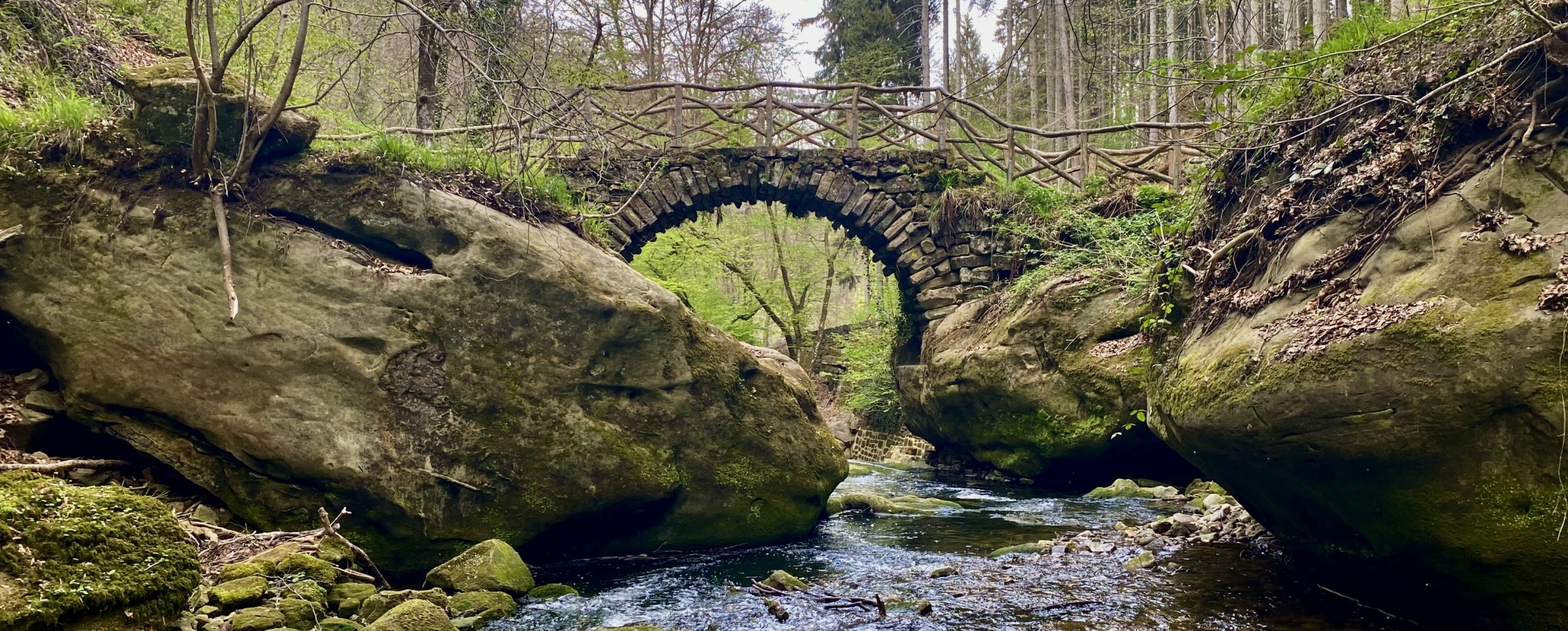
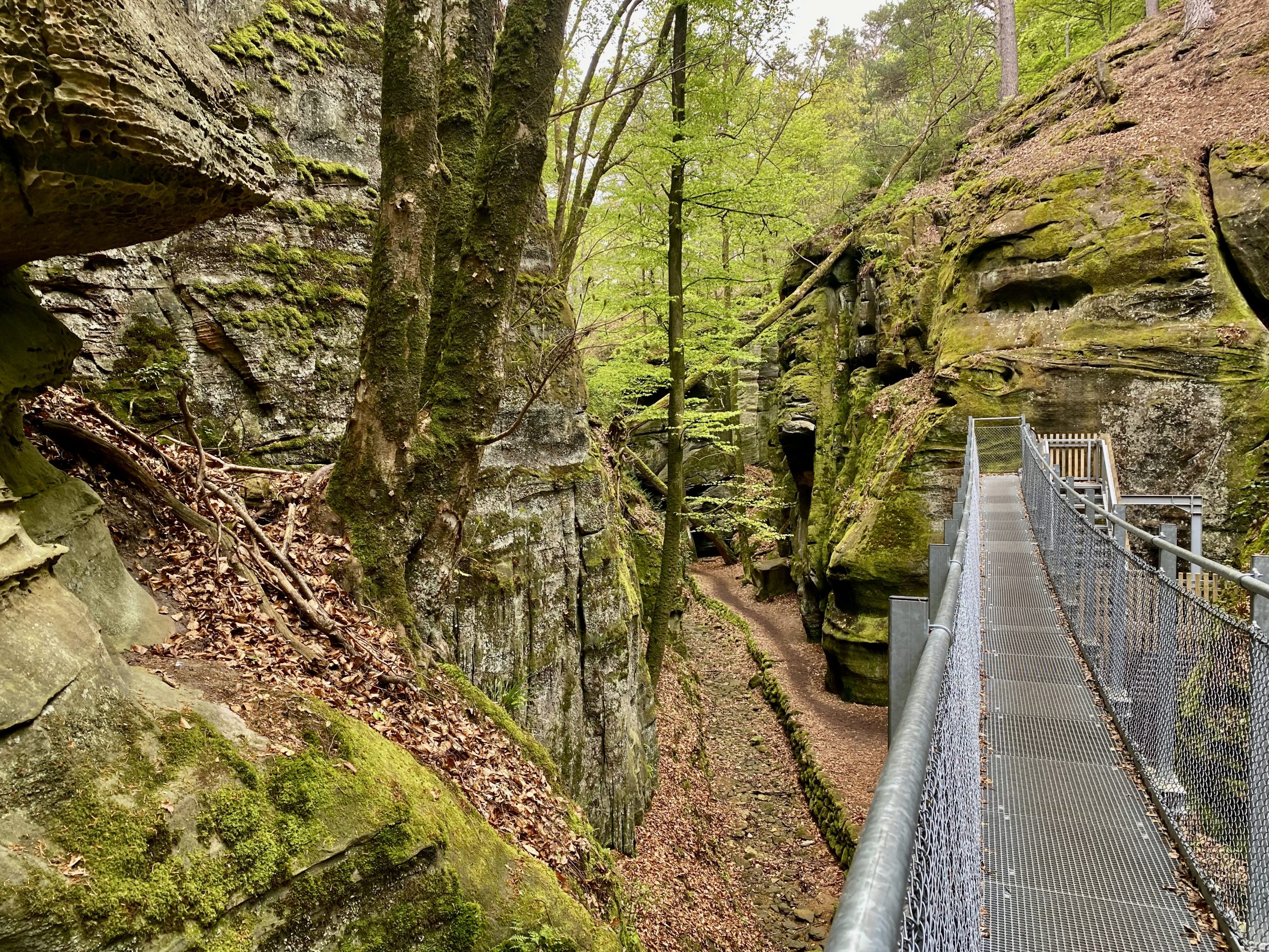
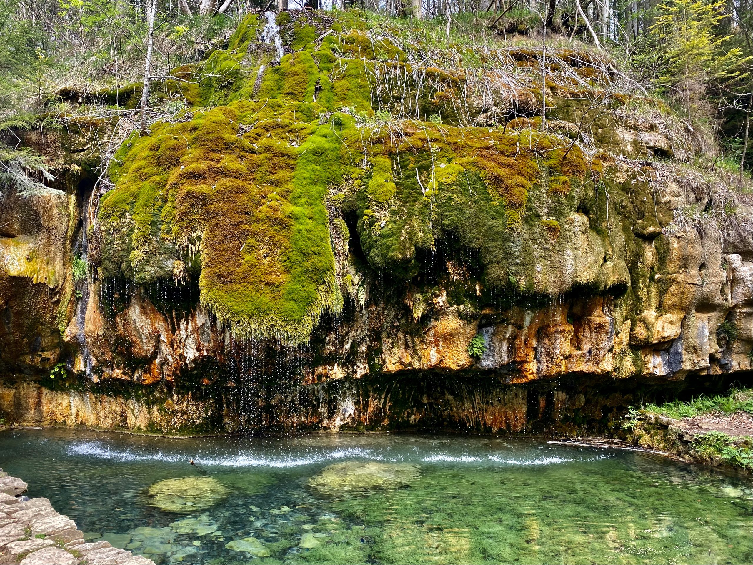
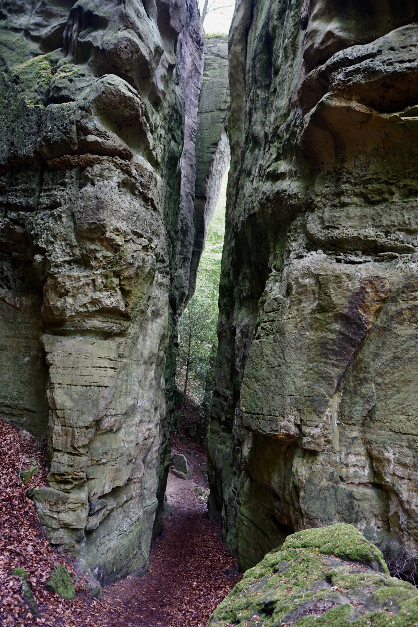
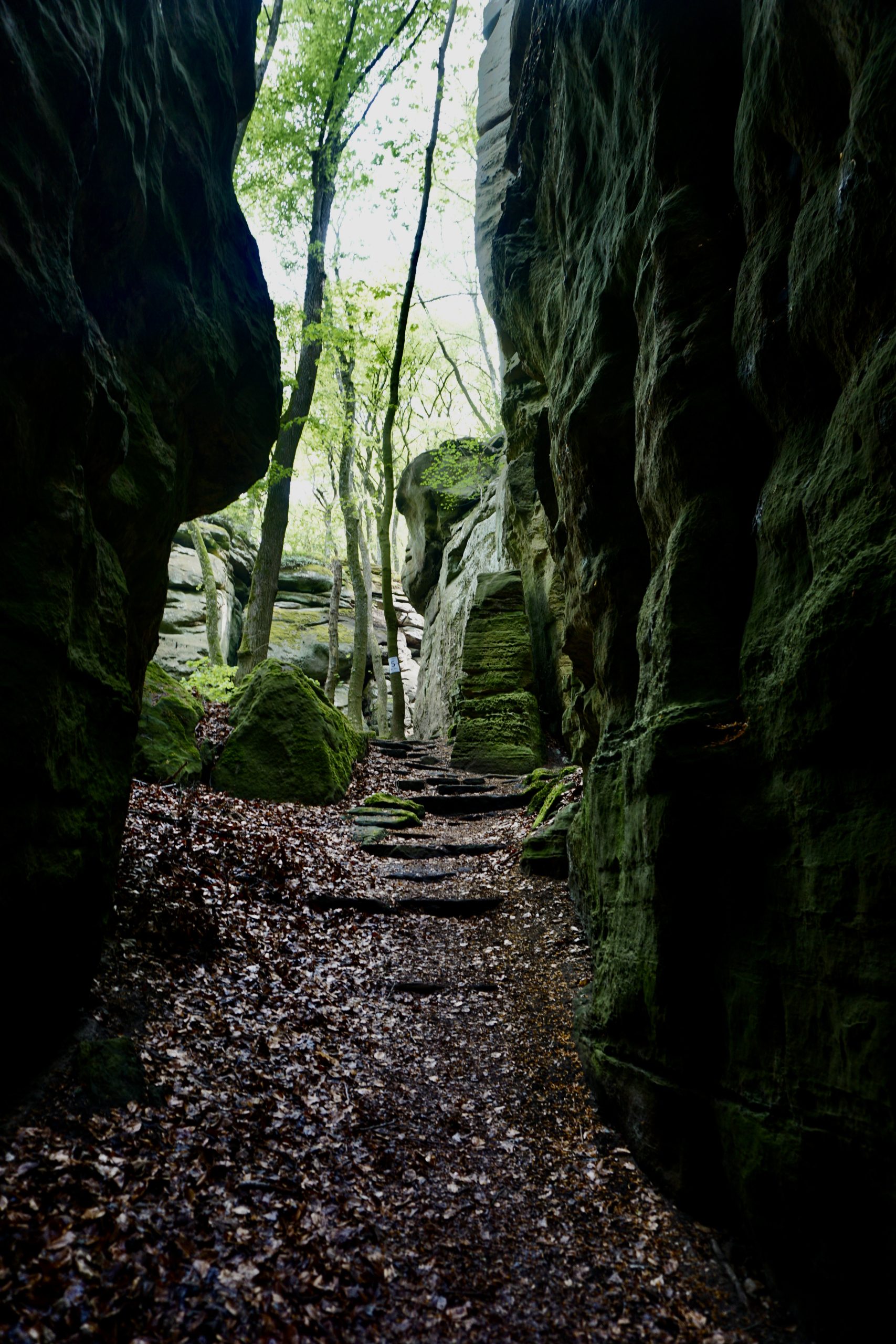
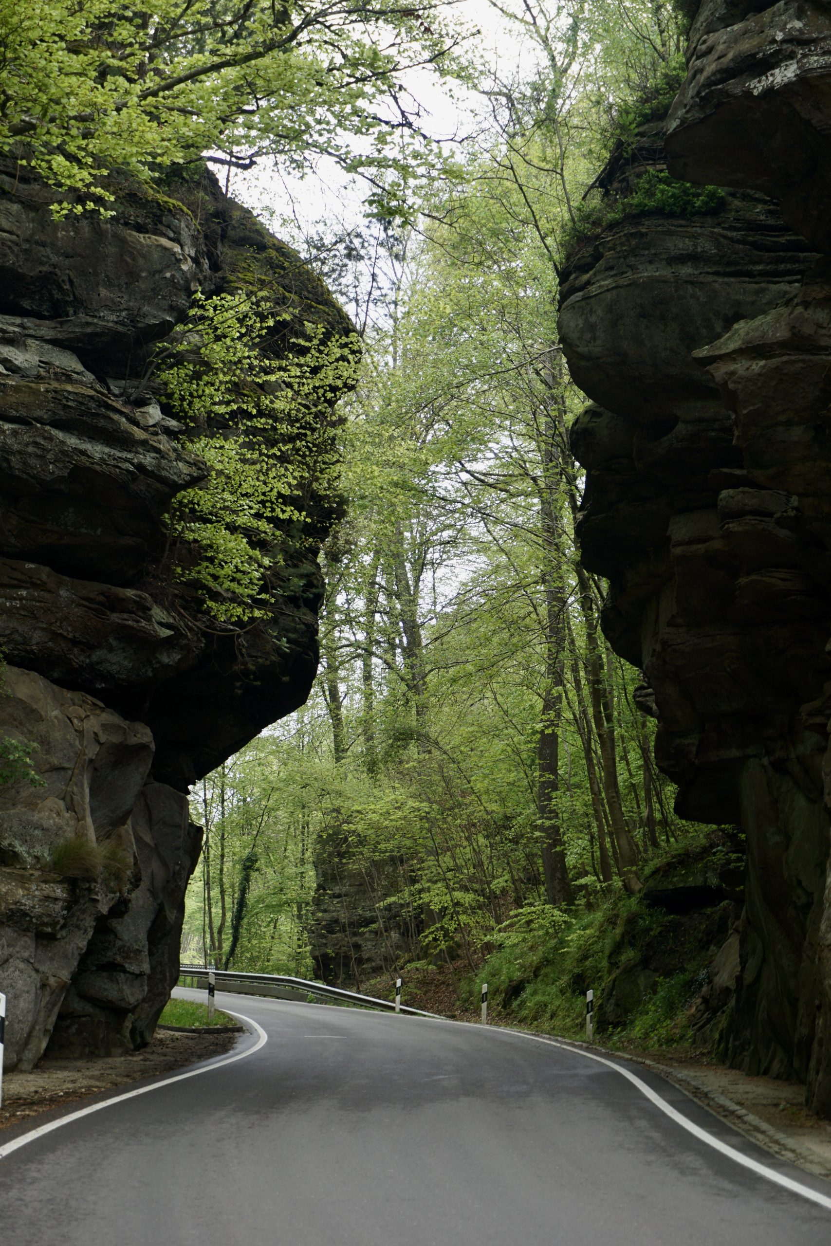
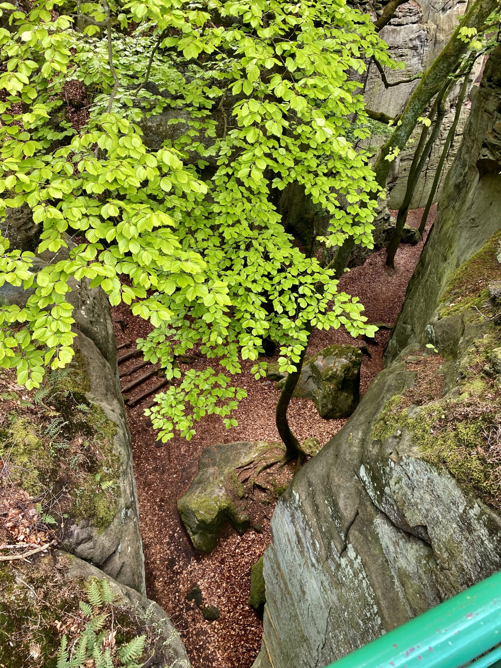
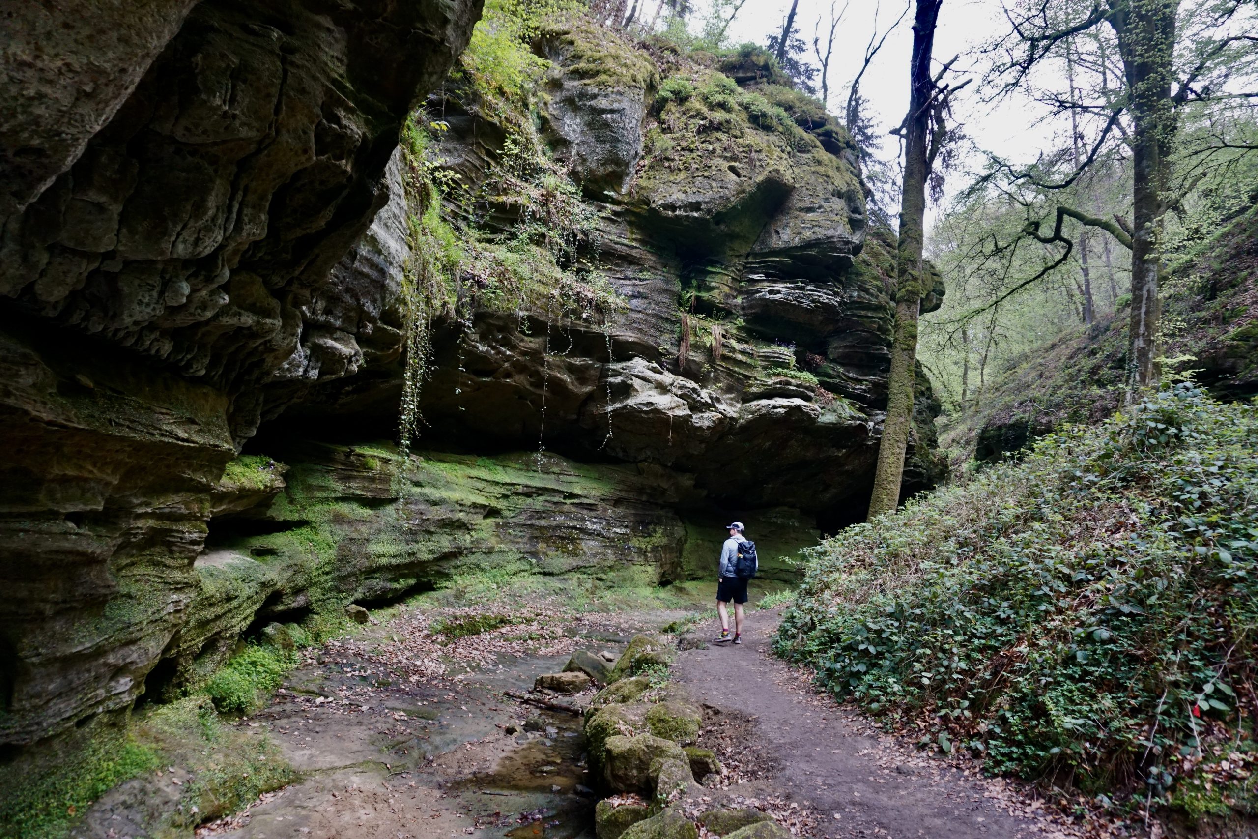
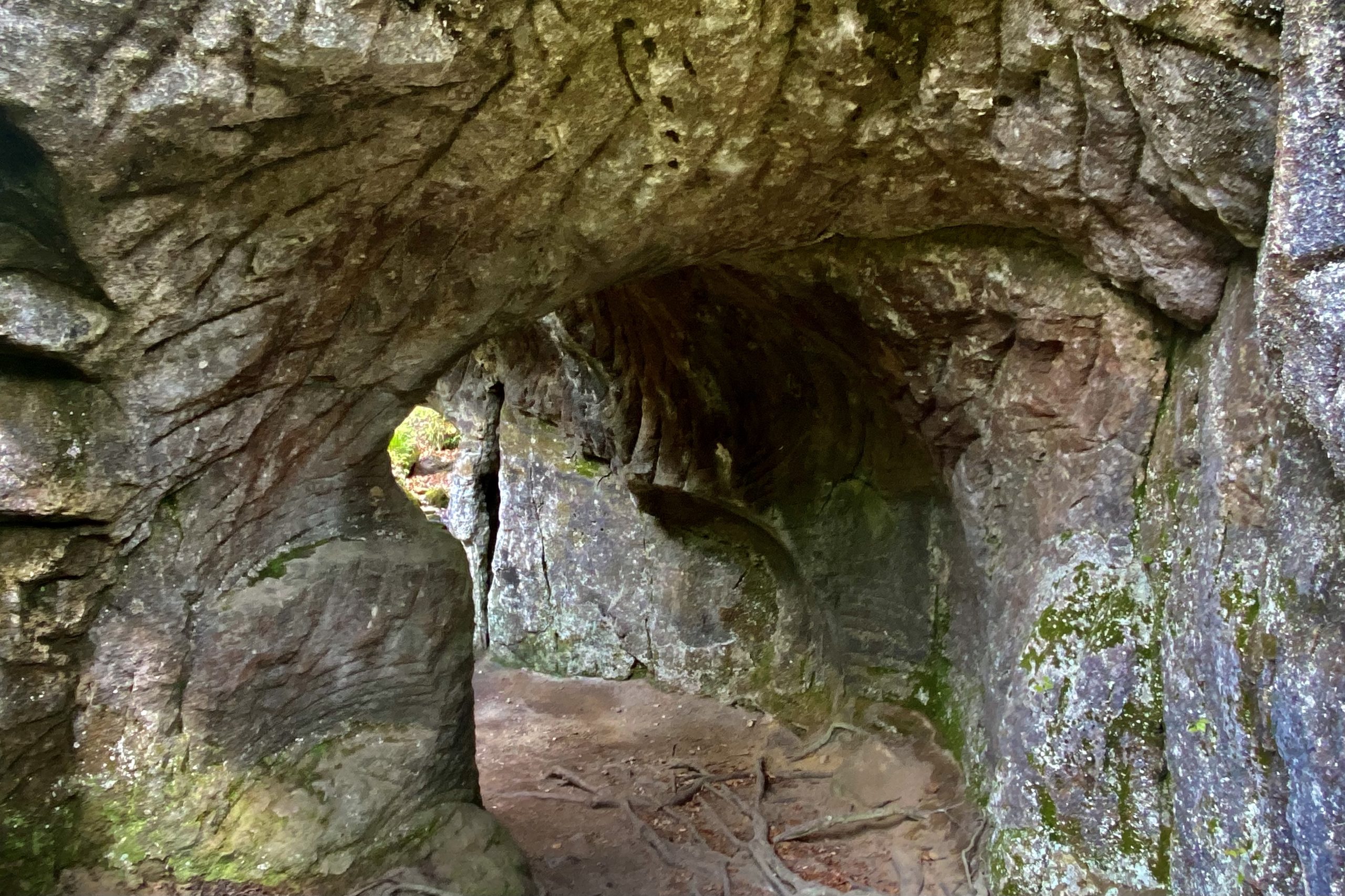
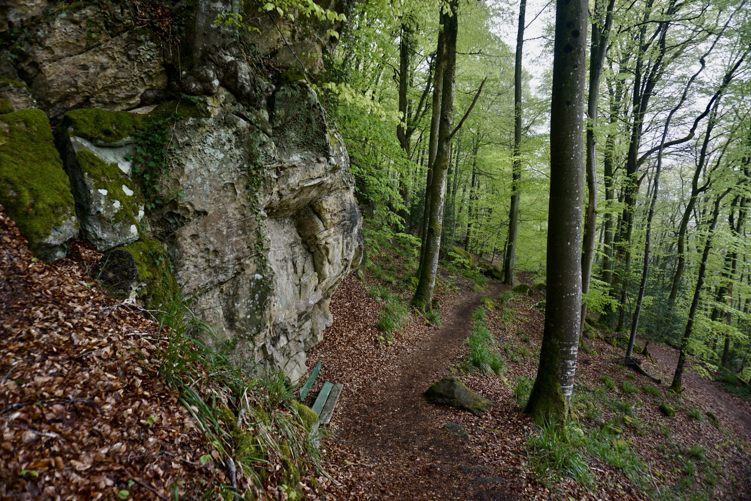
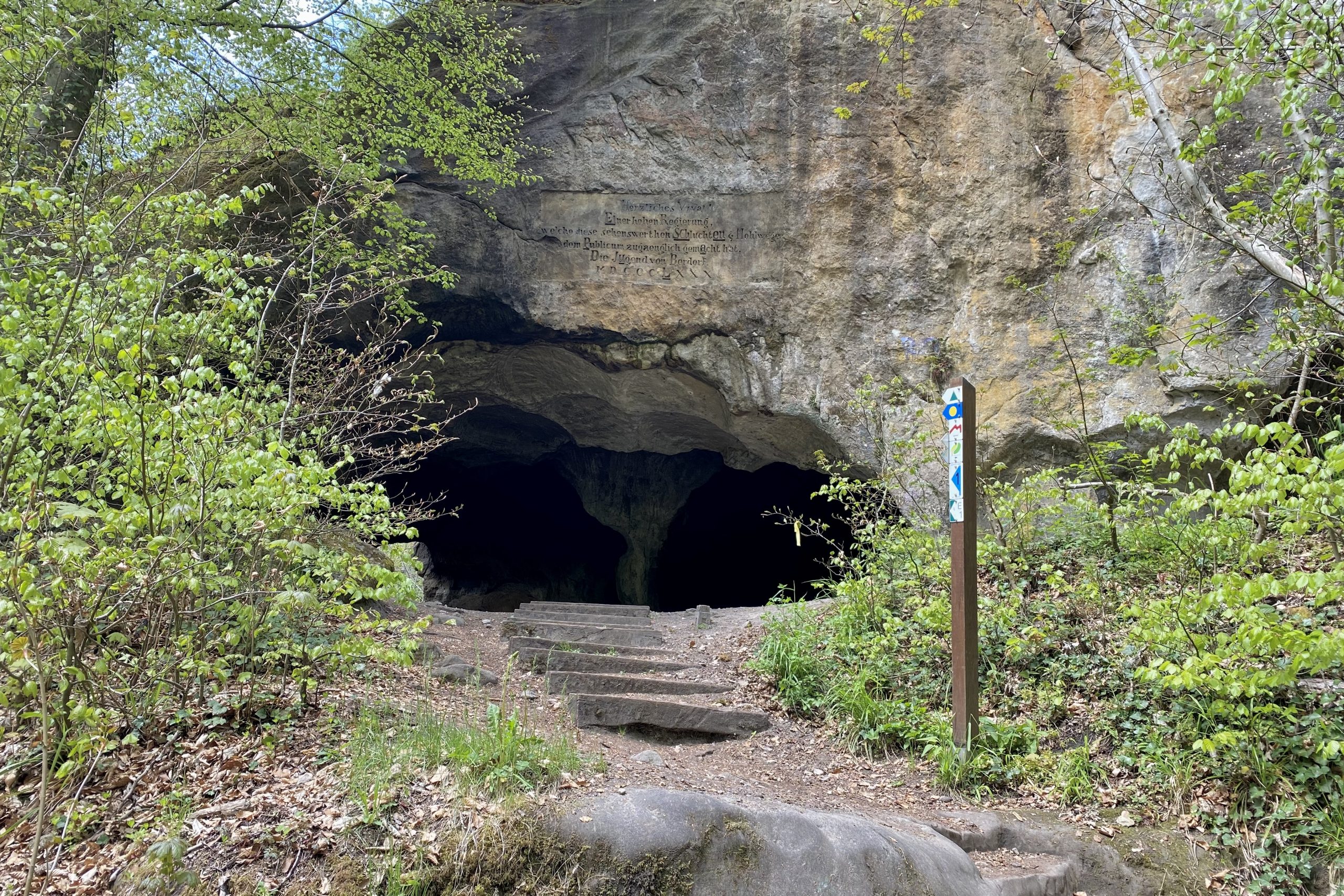
Why we chose it: We chose to hike this trail because of its accessibility (we hiked in late April) and we were intrigued by the rock formations for which this trail is known. Back when we lived in the Czech Republic, we explored quite a lot of similar rocky hills, so we wanted to see whether Luxembourg has something similar. We were not disappointed 😉

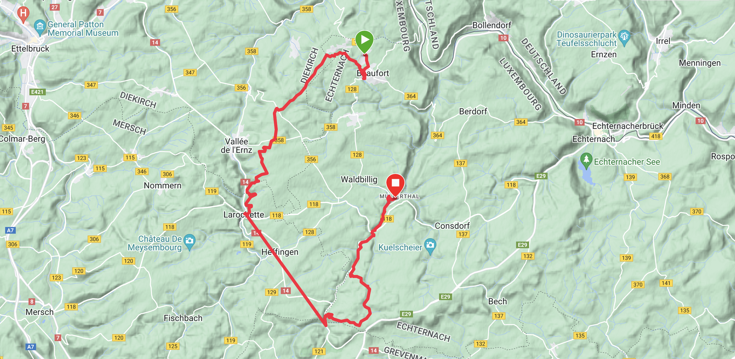
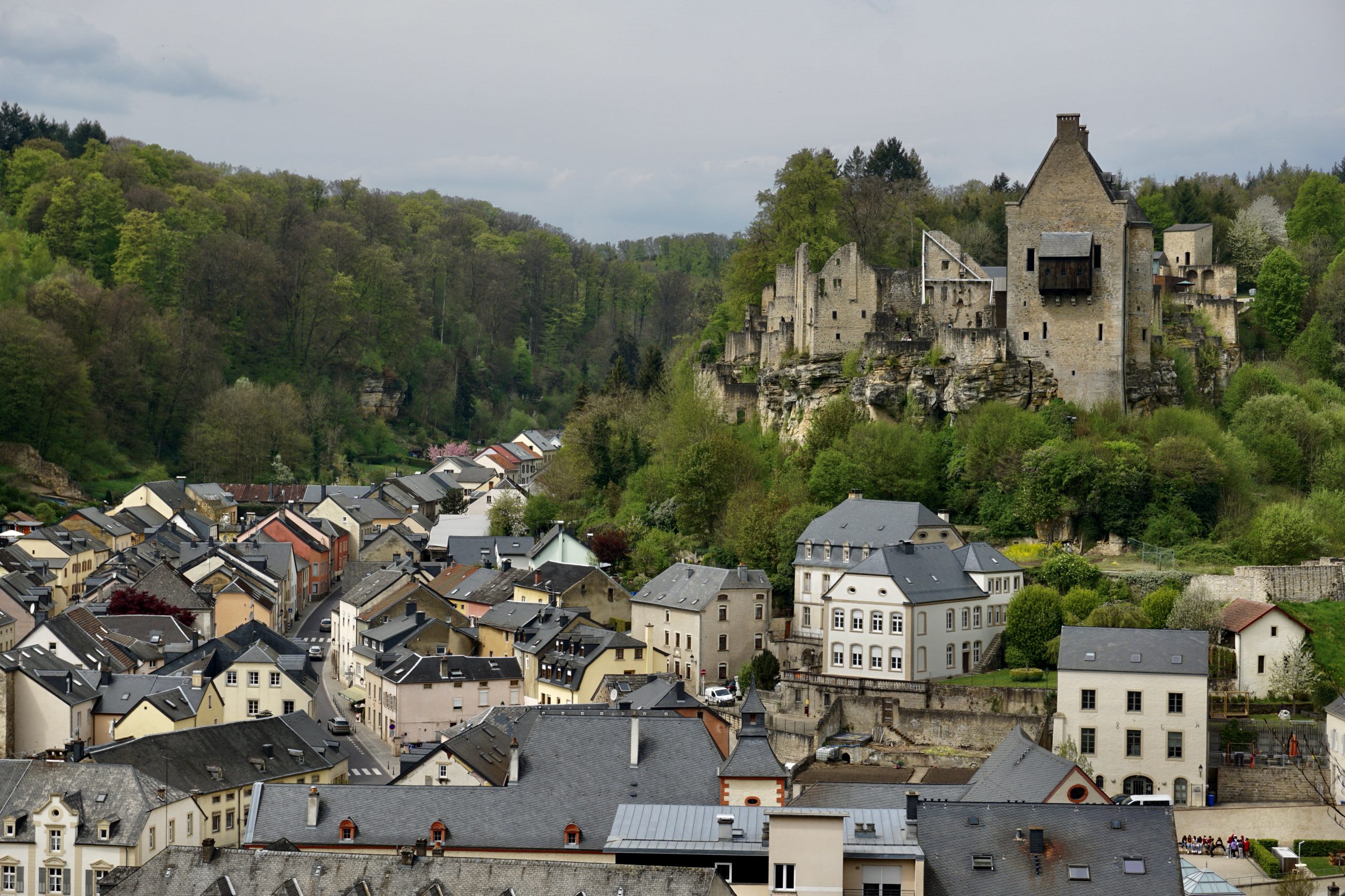
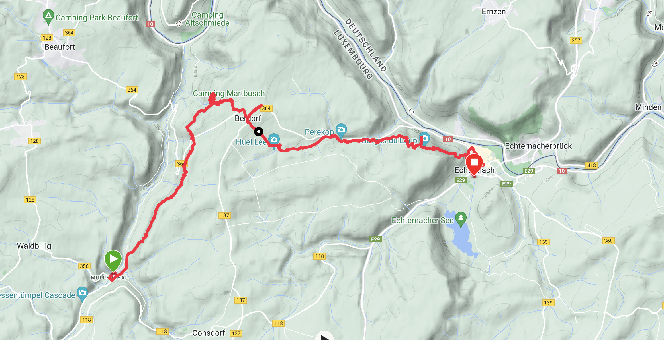
How long does it take: The whole trail (all three Routes) takes between 4 to 6 days if you’re there to just walk the trail. I can easily see someone extending their trip and staying longer in the villages on the way to explore the nearby castles (yes, there will be a few castles!). There are a few side tours as well, each adding between a few hours to a day extra per tour. We hiked Routes 2 & 3 and it took us three days. 

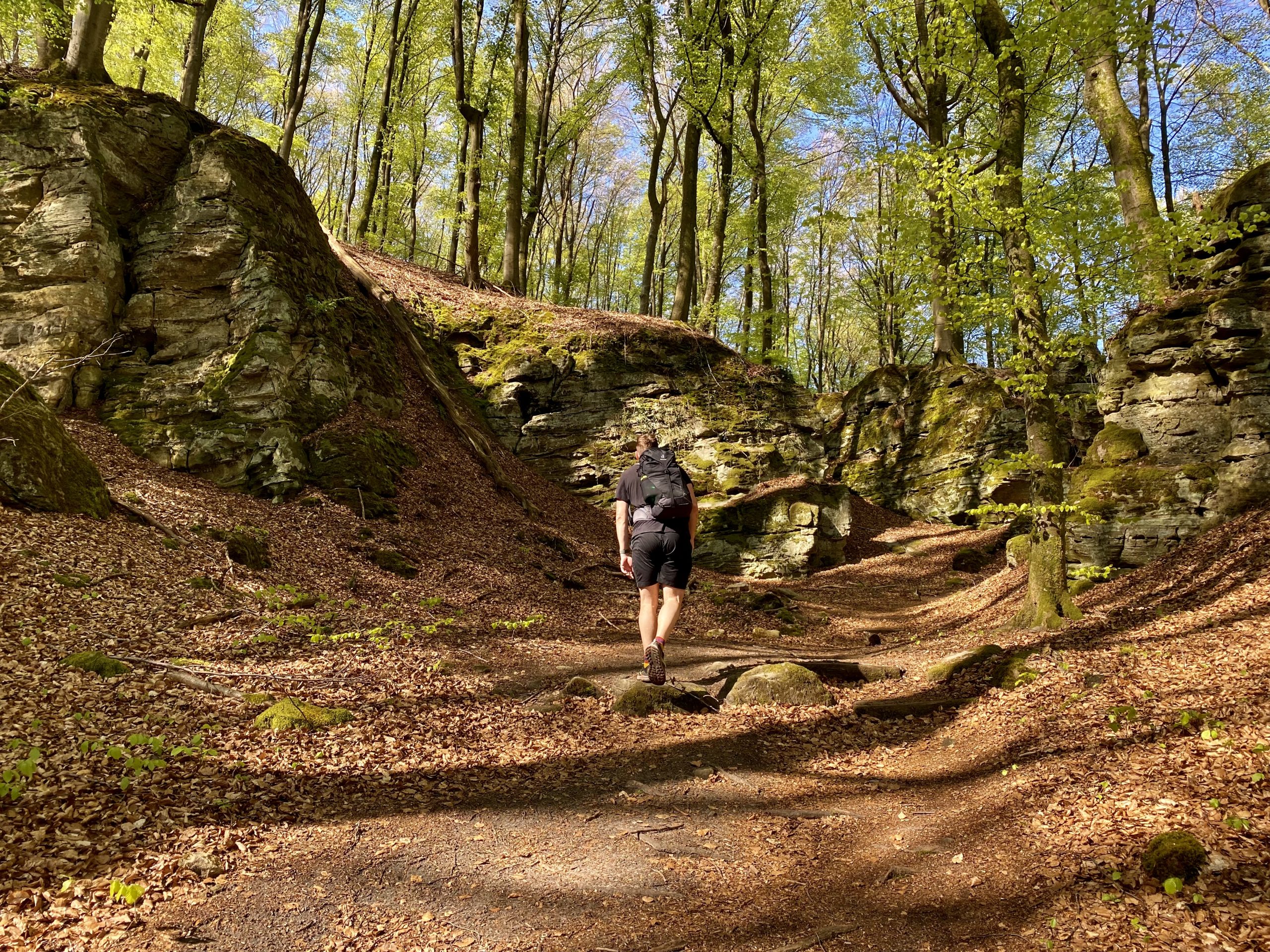
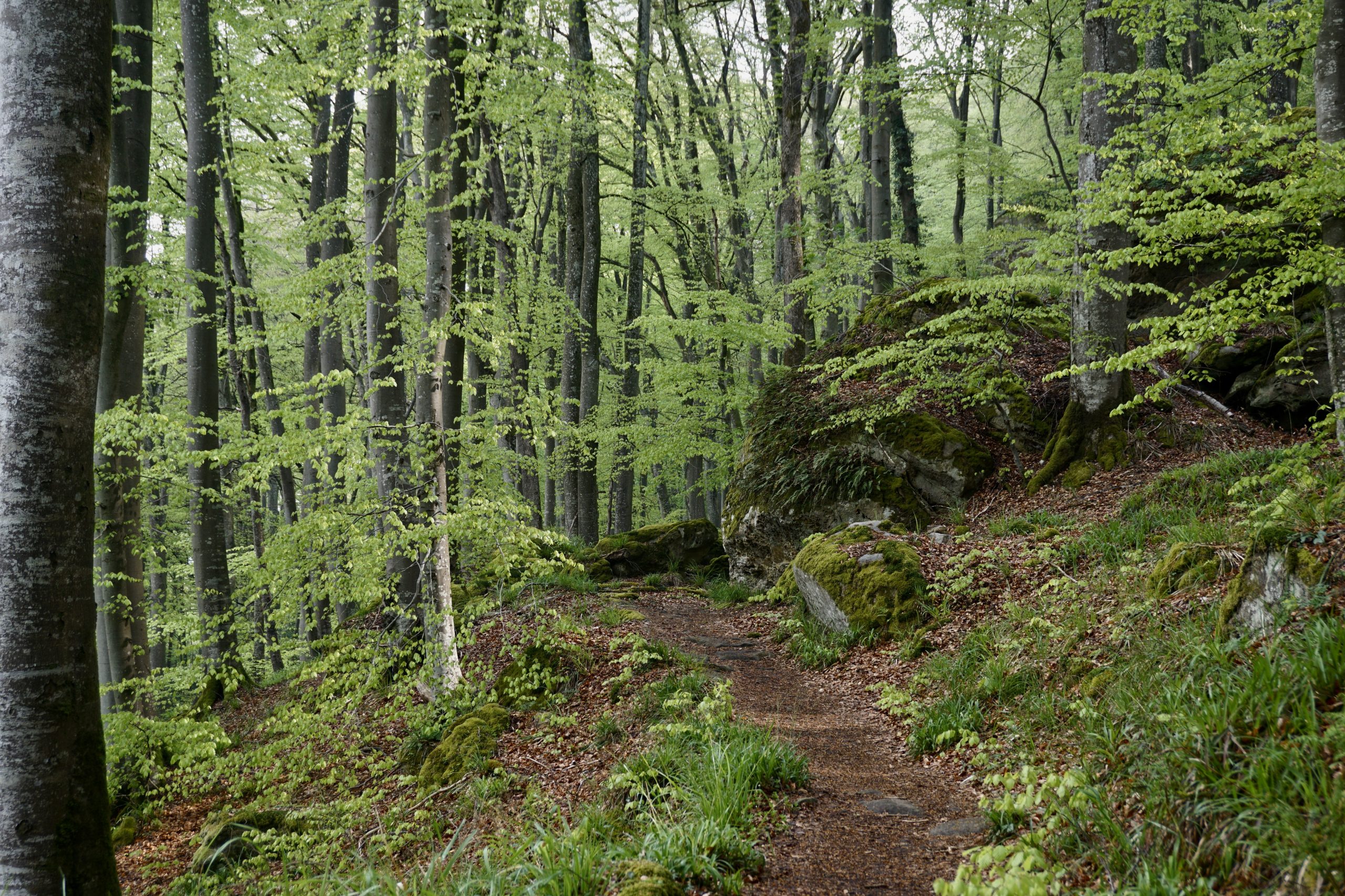
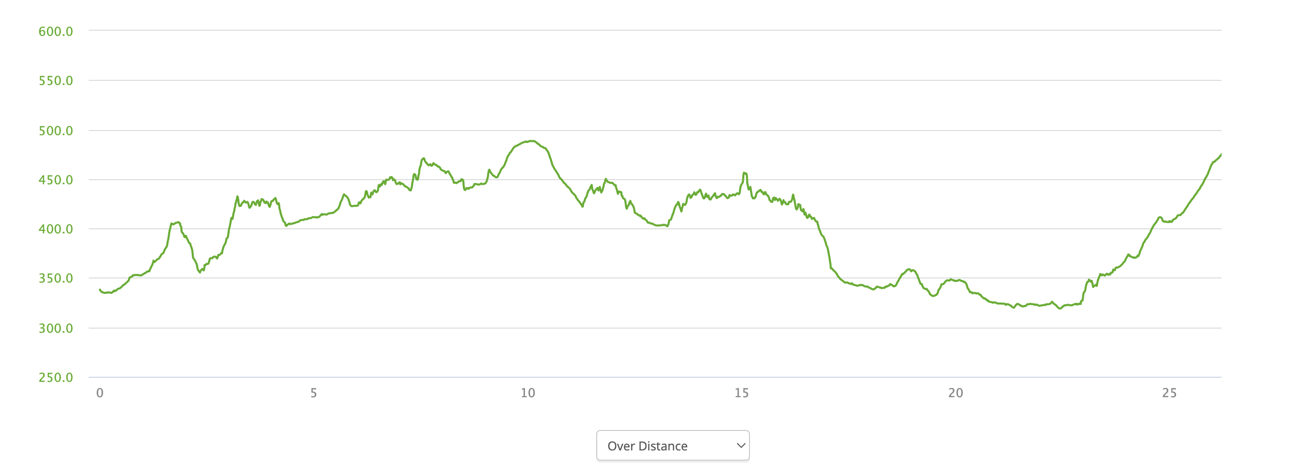
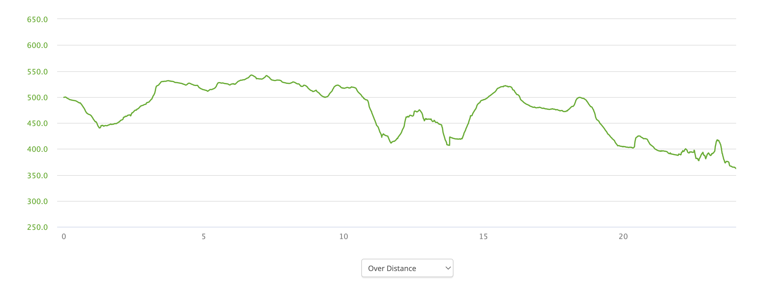
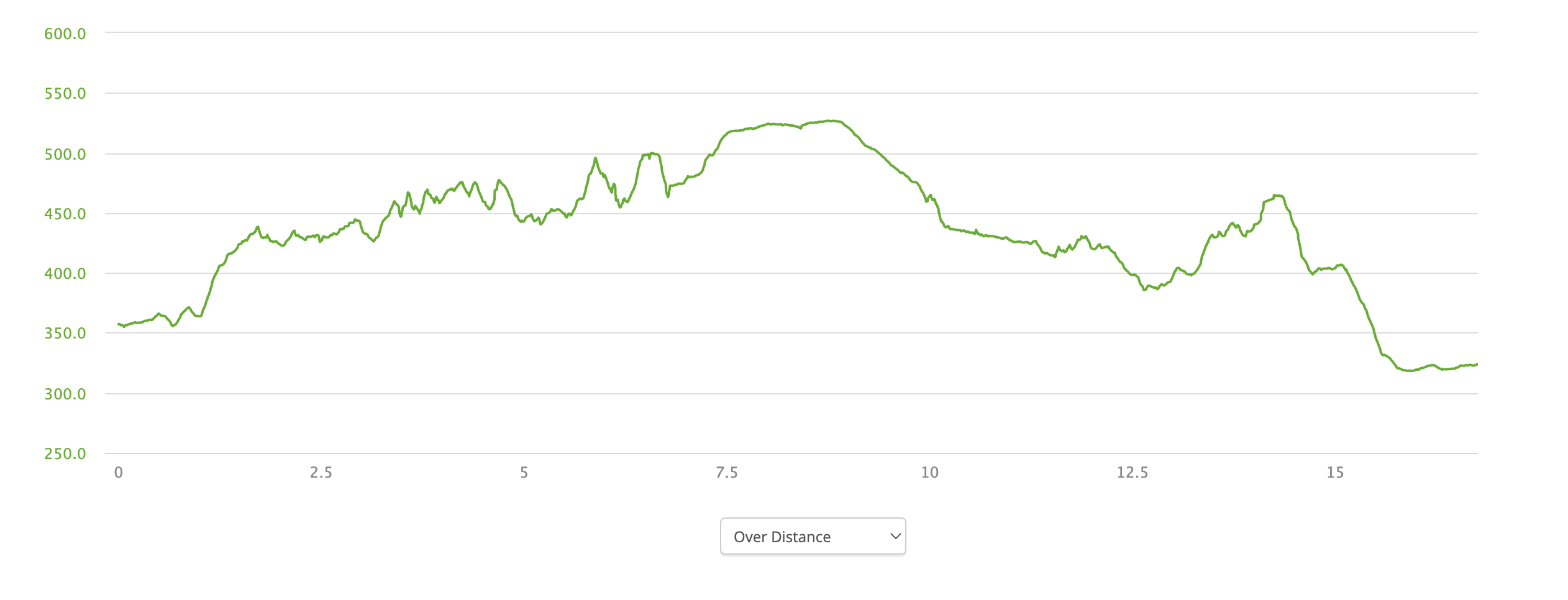
Difficulty: I consider Mullerthal an easy trail. There are no crazy elevation gains or losses and the trail terrain is not difficult. Some sections are more hilly and include stairs, but it’s not like you need to climb stairs for an hour. It is a great trail for beginners or if you want to practice long-distance hiking before hitting some serious mountains. 

Navigation: The trail is marked very well and it even has its own branded marking – a red M letter on a white background. You’ll see the red M signs frequently enough to be able to follow the trail easily. Besides, you’ll rarely be out of phone signal, allowing you to double-check on any navigational app whether you’re on the right spot. Paper maps and compasses are really not necessary on this trip, you’ll never be away from the civilization more than a few kilometers.

Itinerary & accommodation

Trail start: The trail starts…whenever you want it to start. As it’s made of circles, you can start anywhere that’s most handy for you. Public transport is well developed (and free!), so you can easily reach any village with a bus stop.

Where we started: Our itinerary was dictated by the accommodation. As we decided to stay in hotels instead of camping, we had to plan the hike based on their availability. That’s the main reason why we started in Lauterborn. To get there, we took a train to Luxembourg city and from there we took a bus with a switch. As we arrived late in the afternoon, we stayed in a hotel (Hotel Au Vieux Moulin) and started the hike the next day. It is also possible to fly to Luxembourg as it has its own airport. 

Trail map day 1
Elevation profile day 1 (in meters)

Day 1: Lauterborn – Mullerthal – Beaufort​

Distance: 26km

Hiking duration: 5h 40min

Total duration (hiking + rest): 7h 50min 

Total ascent: 714m

Total descent: 572m

Accommodation: Hotel Meyer Beaufort

Overall impression: The day started with gentle hills in a forest. Close to Mullerthal, there were plenty of narrow labyrinths between tall rocks, some of those even required a flashlight as it was very dark. Very cool! We had a long rest in Mullerthal, after which there was still 8km till Beaufort. The path there follows a stream almost all the way, later finishing with a walk in a beautiful gorge. 

Forest walk along the Mullerthal trail
Trail map day 2
Elevation profile day 2 (in meters)

Day 2: Beaufort – Larochette – Mullerthal

Distance: 24km (excluding the bus ride)

Hiking duration: 5h 00min

Total duration (hiking + rest): 7h 00min 

Total ascent: 452m

Total descent: 591m

Accommodation: Hotel-Restaurant Le Cigalon

Overall impression: On this day we saw two castles that both can be visited if you have more time. There was quite some forest and field walking between Beaufort and Larochette, which was a bit monotonic at times. Therefore, we decided to take a bus from Larochette to Blumenthal to shorten a long day and rest from a field walking (that straight red line is not a neat walk). Close to Mullerthal we once again were back in the hills with rocky formations and got to see the famous Mulerthal bridge.

Larochette and its castle
Trail map day 3
Elevation profile day 3 (in meters)

Day 3: Mullerthal – Berdorf – Echternach

Distance: 17km

Hiking duration: 3h 45min

Total duration (hiking + rest): 5h 45min 

Total ascent: 538m

Total descent: 591m

Accommodation: Hotel Francais (Luxembourg)

Overall impression: The shortest, but definitely the most picturesque day of the trip. It was interesting and beautiful the whole way to Echternach. Close to Berdorf, we took a small detour to explore the mazes between tall rocks in Gorges du Loup. We almost got lost and almost got stuck (not kidding, it’s super narrow in some sections!). There are quite some stairs, so even if elevation is not crazy, you’ll get a decent workout. If I had only one day for Mullerthal trail, this would be the day. Beautiful!

Rock formation Huel Lee

Gear

This hike was a luxury multi-day hike for us as we didn’t have to carry any camping gear and stayed in hotels every day. Woohoo! Thus, I didn’t care about my backpack weight as much as on other hikes. Besides, we were always close to a town, so there was really no need to take a lot of stuff. When it comes to clothes, I included in the list all the clothes, including the ones I wore.

A special shoutout to the first-aid kit: even if you are close to the civilization, I advise you to always take a first-aid kit. At the end of the first day, I found out that I caught not one, but even two ticks! Luckily I had a tick pencil in my first-aid kit, so Edo easily could remove them. I also had a few alcohol pads, which I used to clean the “lucky” spots. Ticks are nasty to take out and tick pencil works amazingly well, so make sure you have it in your first-aid kit. Besides a tick pencil, in my first-aid kit, I usually have a few bandages, a bit of medical tape, a few alcohol pads, and some painkillers. 

My gear list:

  • Backpack – Osprey Women’s Sirrus 26 (I use it for day hikes)
  • Hiking shoes – Lowa Innox Evo Gtx Low (there’s no need for heavy hiking boots)
  • Shorts
  • T-shirt x2
  • Long sleeve shirt
  • Sun hoodie
  • Tights
  • Socks x2
  • Underwear x3
  • Hat 
  • Sunglasses
  • Rain jacket
  • Sandals
  • Digital camera
  • E-reader
  • A few cables to charge stuff
  • A few hygiene items (e.g. toothbrush, face cream, etc.)
  • First-aid kit
  • Water bottle
  • A few snacks

Budget

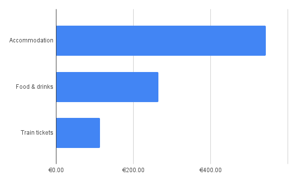
Luxembourg is not a cheap country and staying in hotels instead of camping adds up to the budget. Oh well, the good thing about hotels was that they all offered free breakfast and we feasted during every single one of them. Which in turn allowed us to get away with some light snacks or meals during lunch. In total for two people and 4 nights, we've spent roughly 900 Euros. On the left, you can see a simple breakdown of our costs. Clearly, camping can cut the costs considerably 🙂