Skip to content

GR10: Merens-les-Vals to Llo

Distance (km)
0
Days on the trail
0
Passes crossed
0

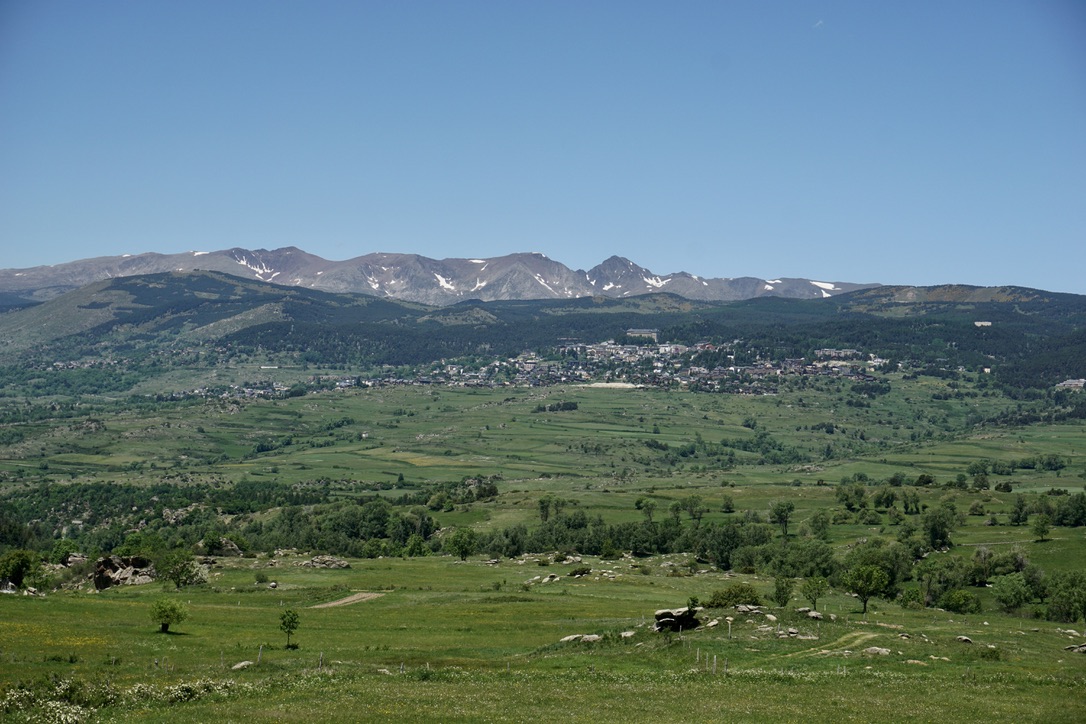
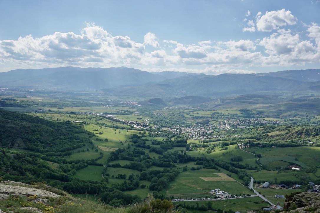
French Pyrenees: I have a feeling that the Pyrenees are a secret kept between France and Spain. The two countries share and enjoy these beautiful mountains while keeping all the “tourists” for the Alps (or Barcelona). Compared to the famous Alps, the Pyrenees are much more local, and 95% of all the hikers I’ve met were either Spanish or French. 

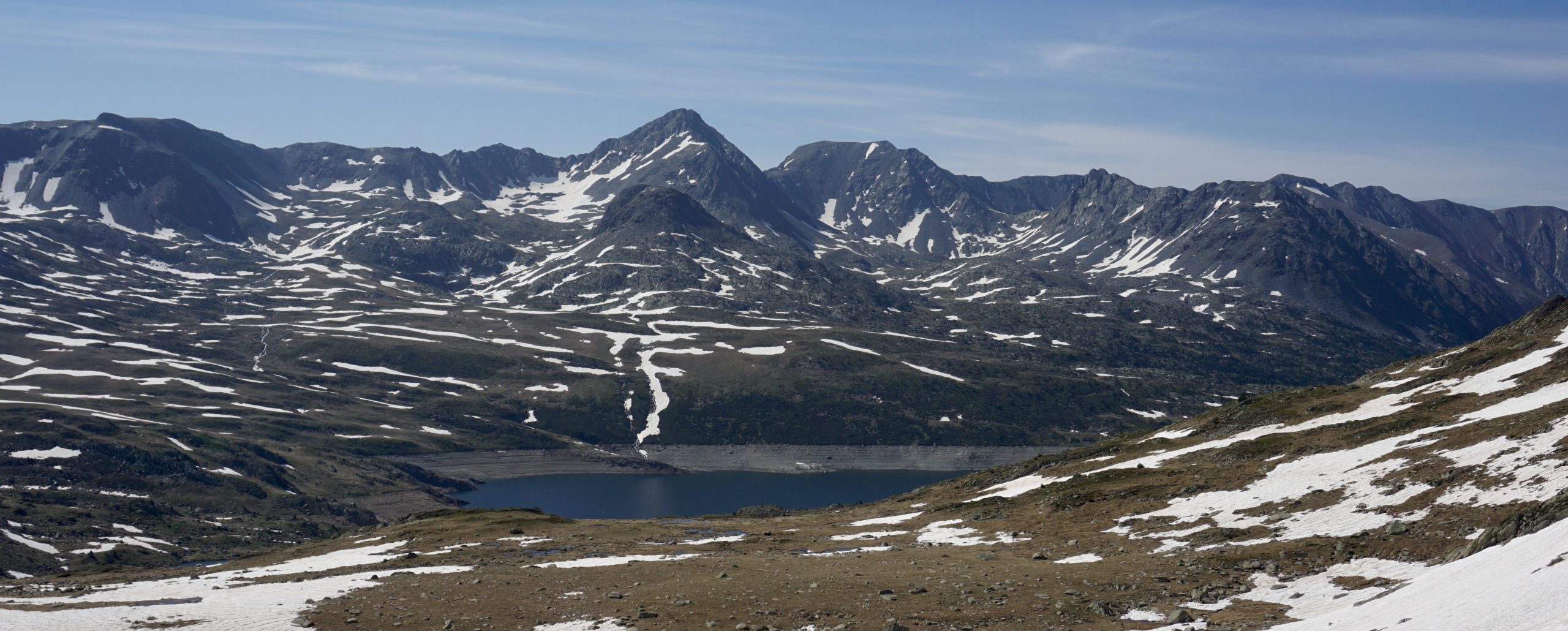
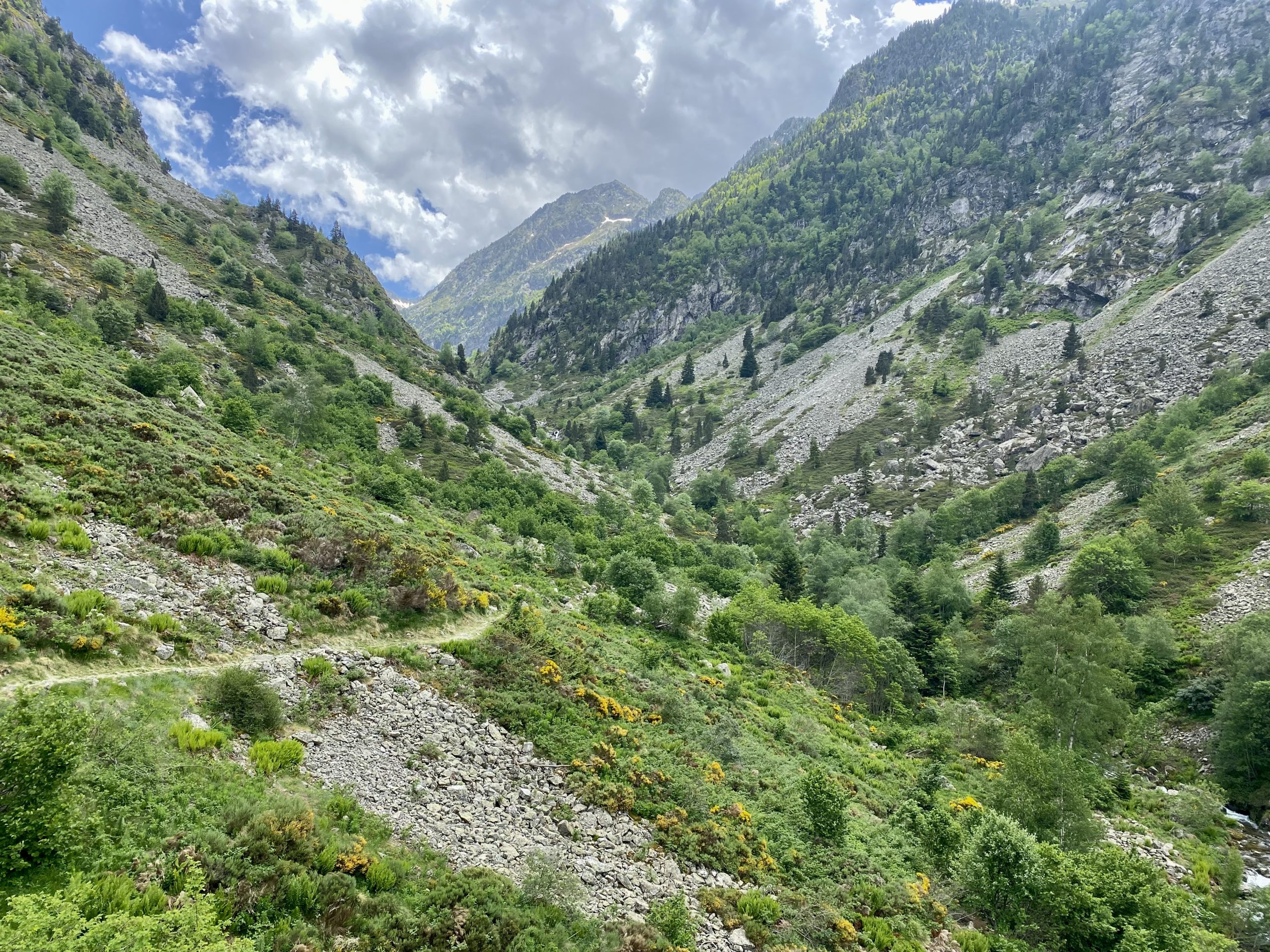
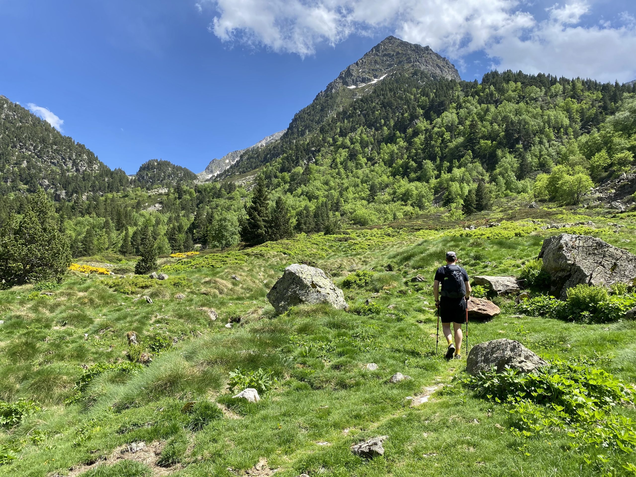
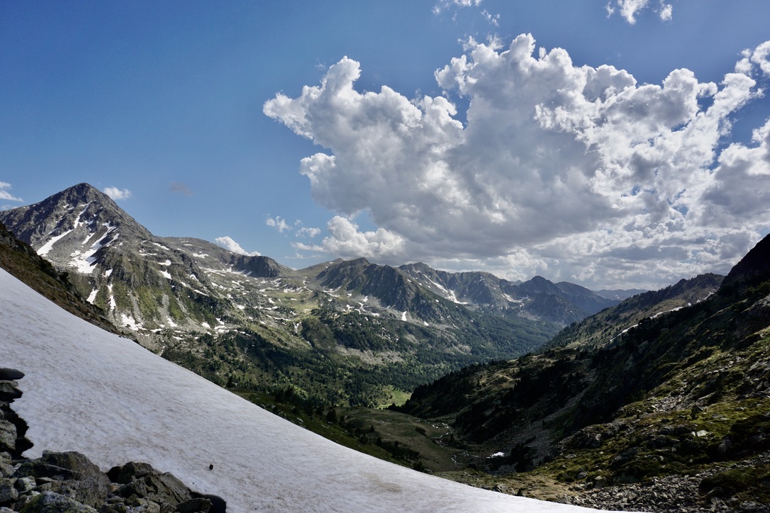
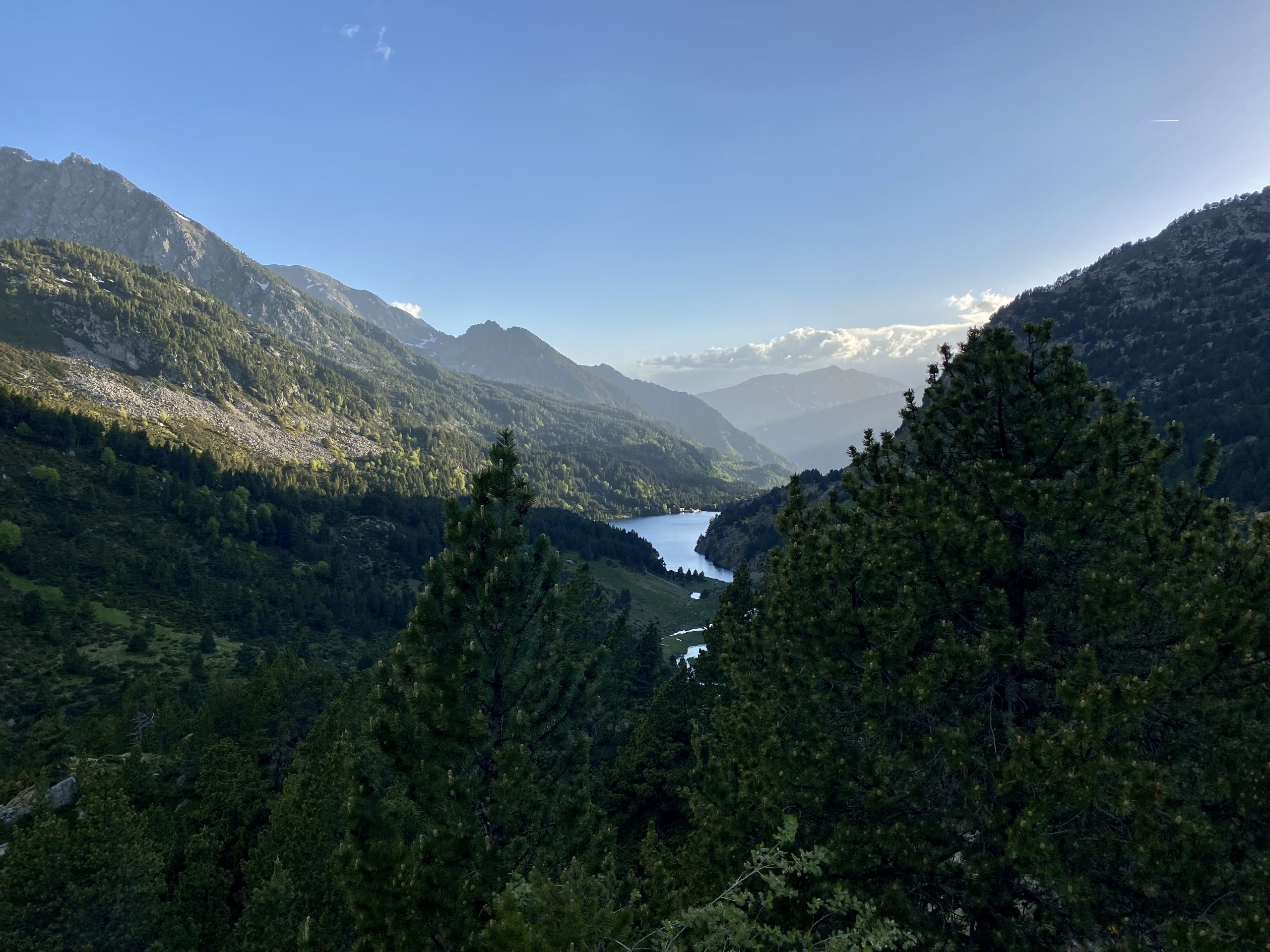
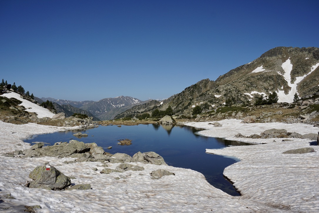
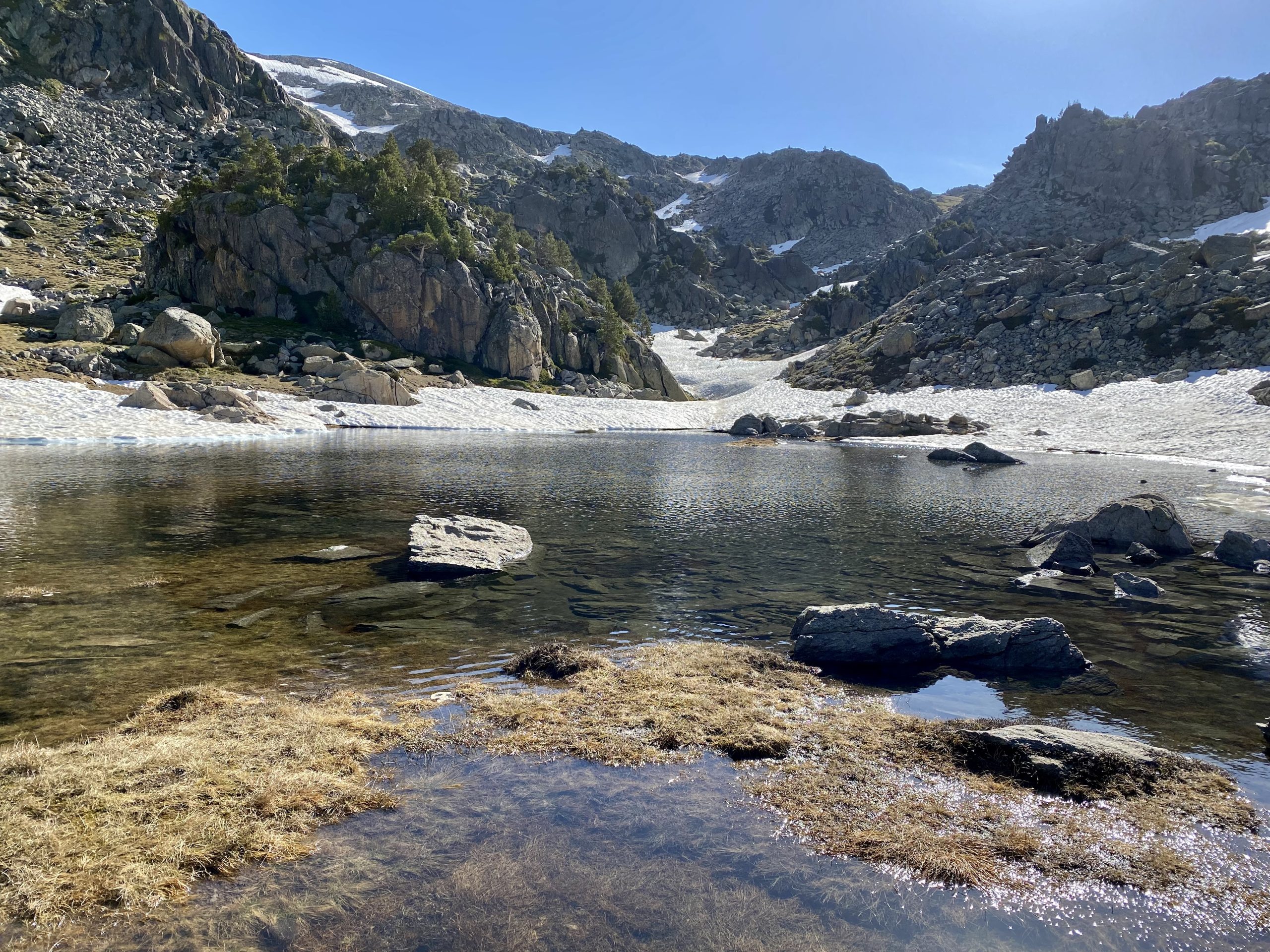
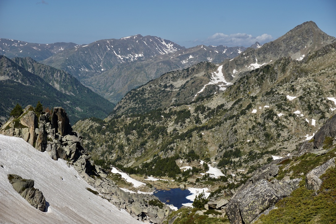
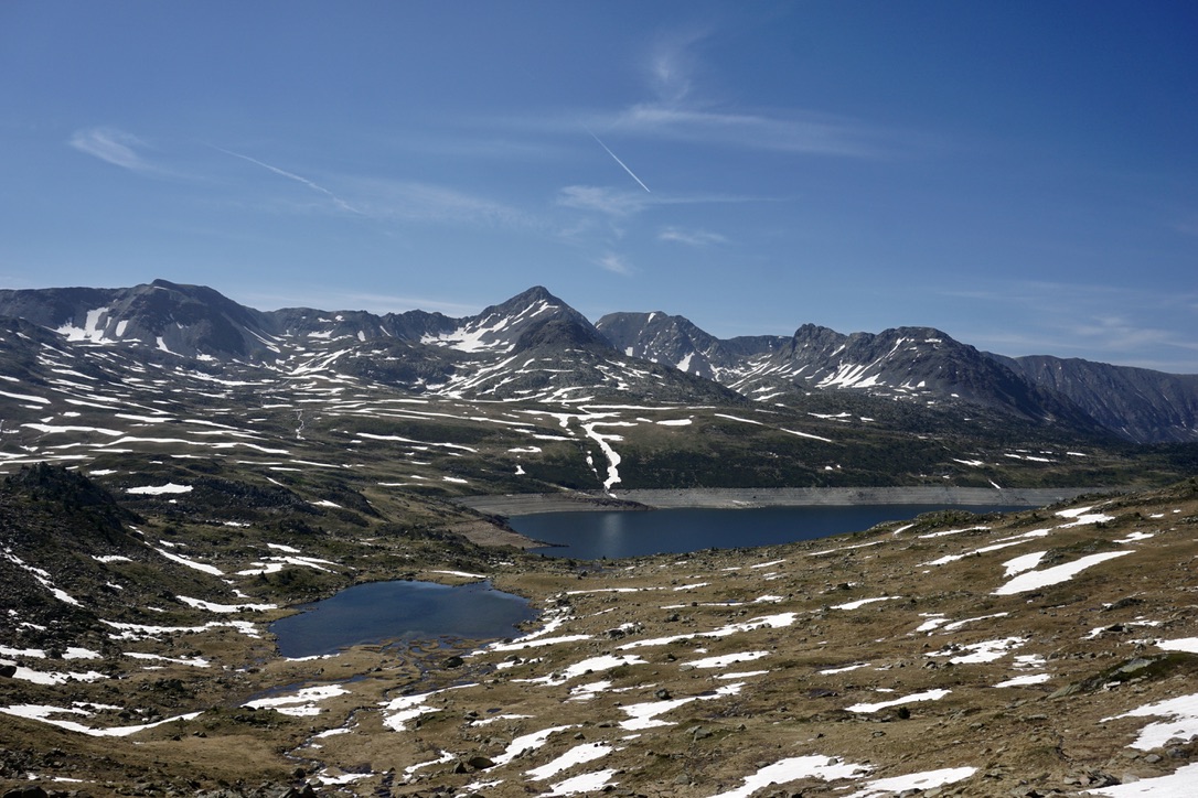
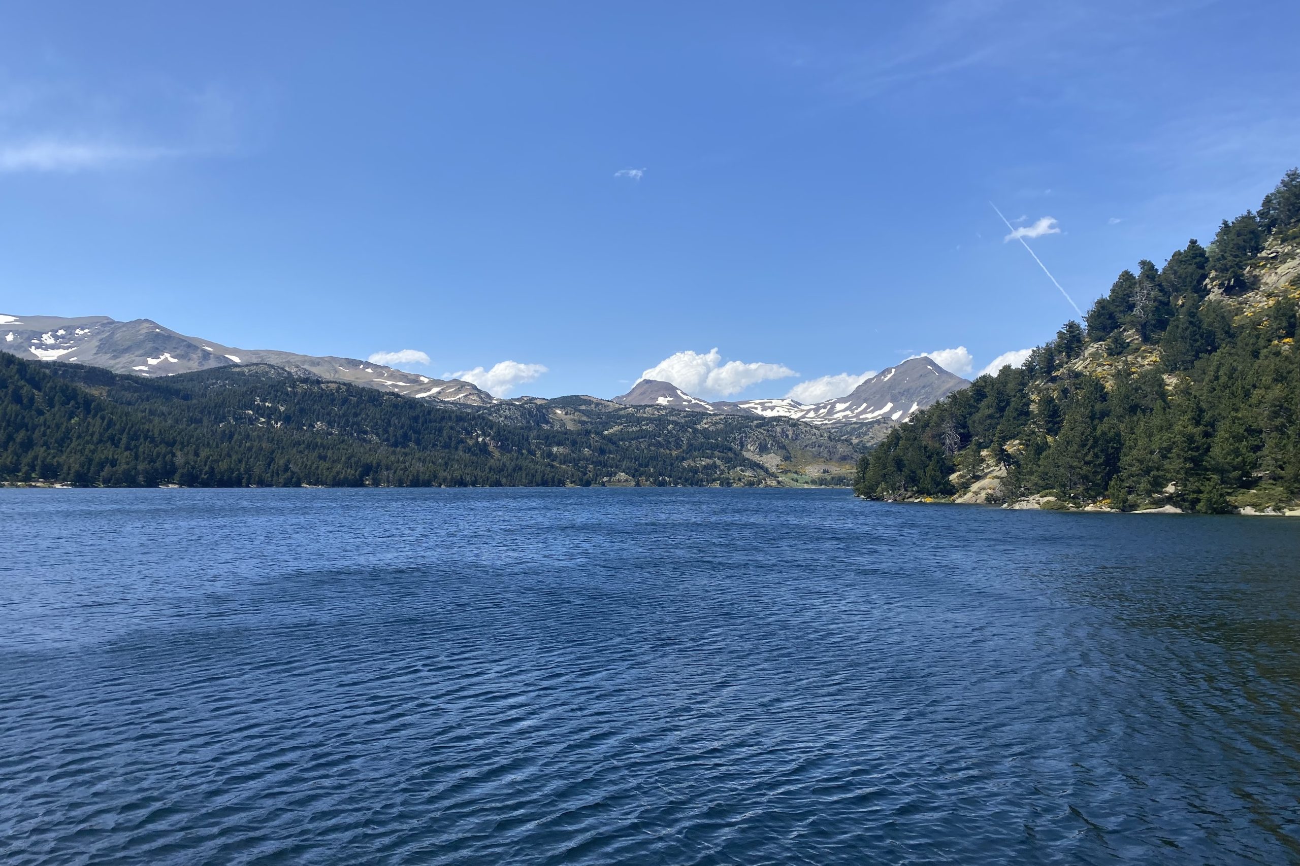
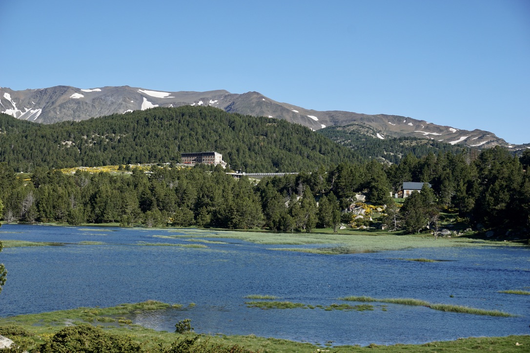
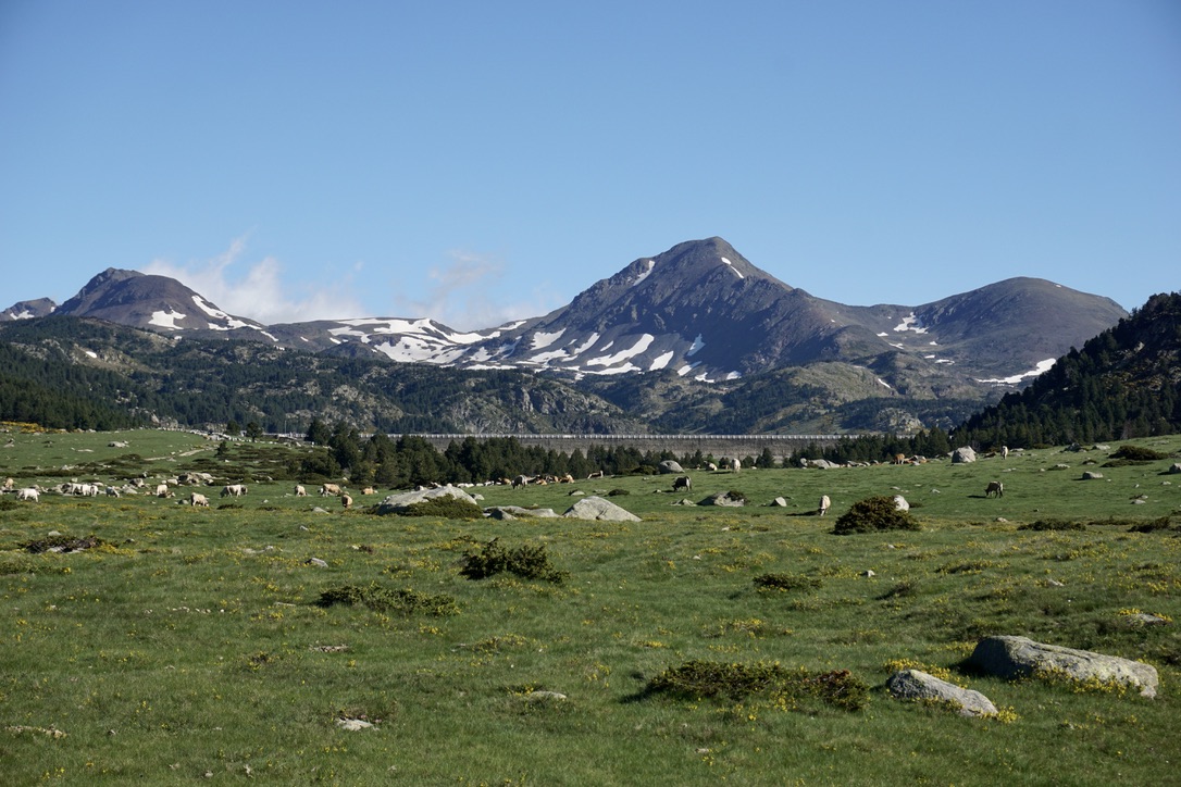
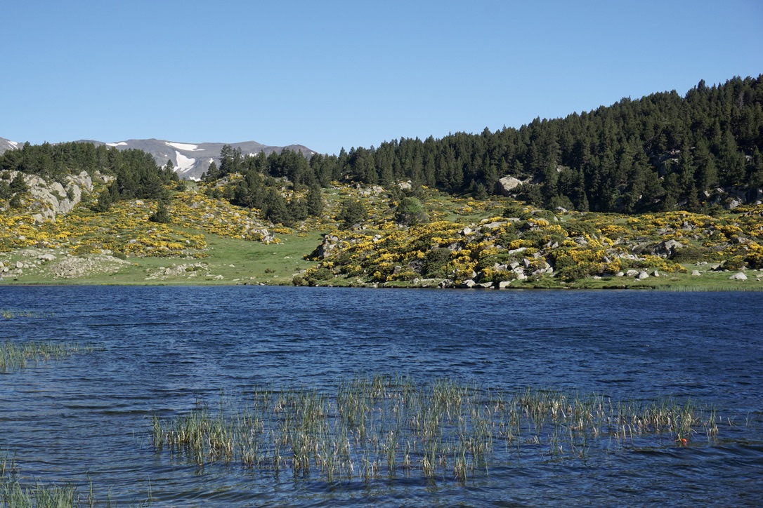
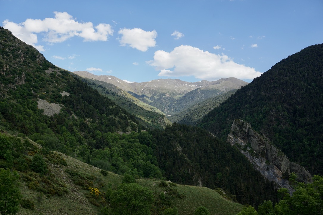
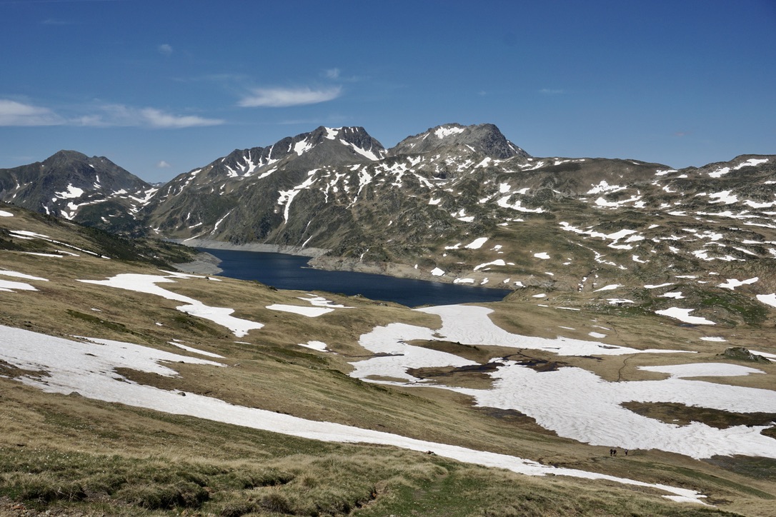
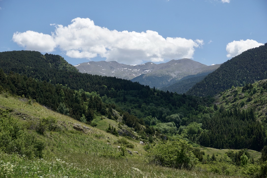
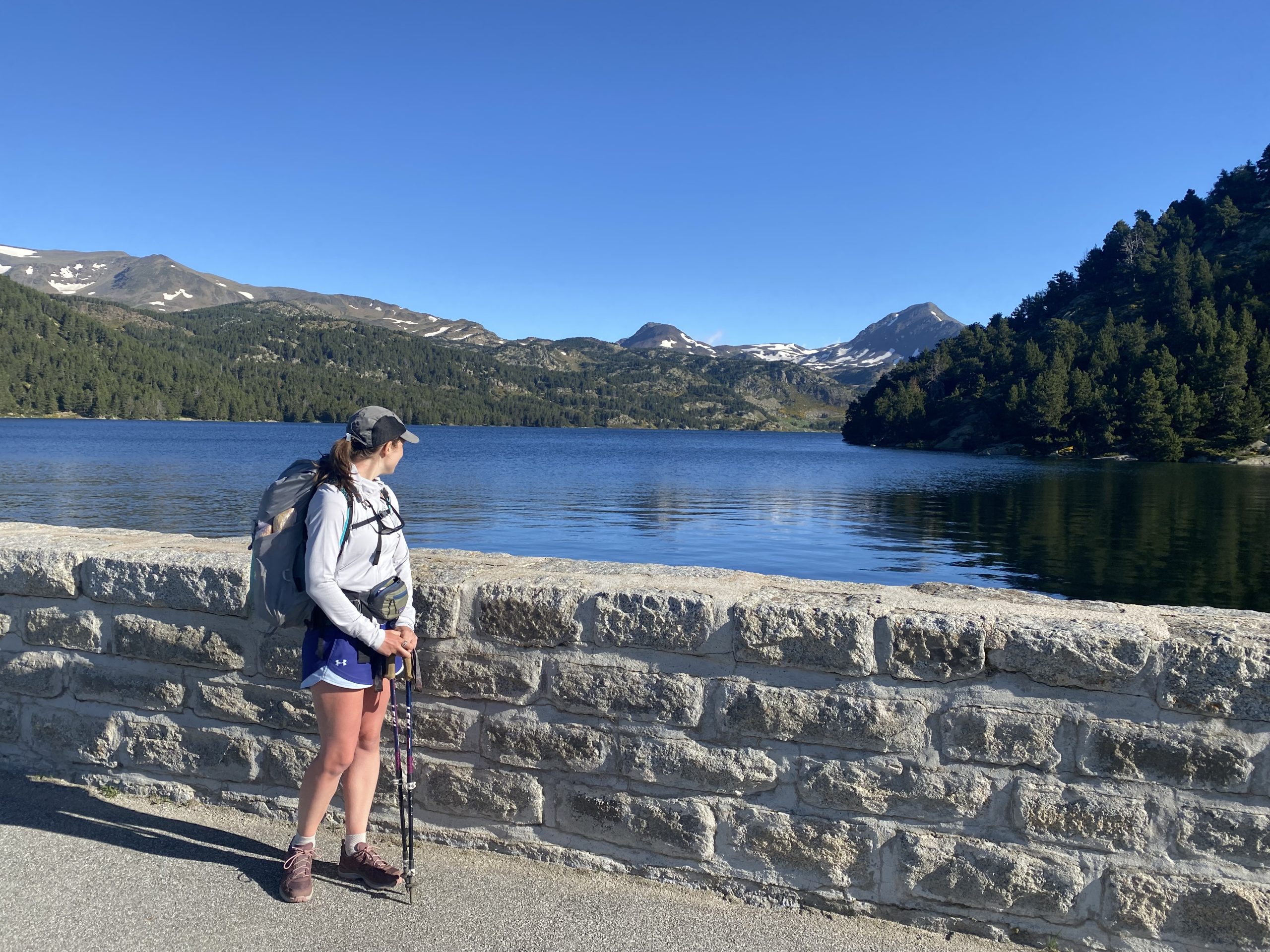
Pyrenees mountains are quite steep and green, while clouds tend to linger above the valleys until late lunch, so you might be able to make those epic “above the clouds” pictures even at 14:00. Countless lakes are a gift sent from heaven during hot days and the water temperature is actually very tolerable. Overall, I fell in love with this region and felt that it has its own unique landscape and vibe. 

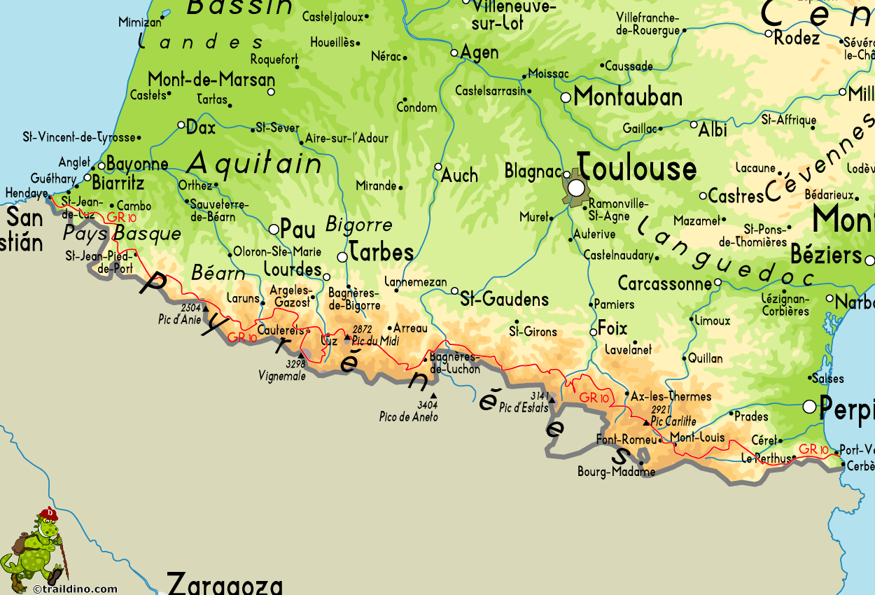
GR10: This trek crosses the whole Pyrenees range from the Atlantic Ocean to the Mediterranean sea (or vice versa) and takes around 45 days to complete. It is a very well-marked trail that will definitely be a good challenge (more than 900km!), but also a great way to explore the very south of France, where the climate and landscape will be changing every few days. 

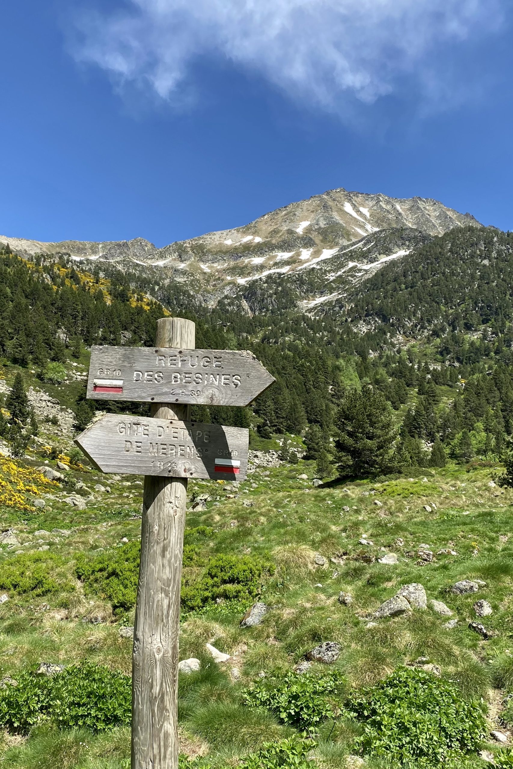
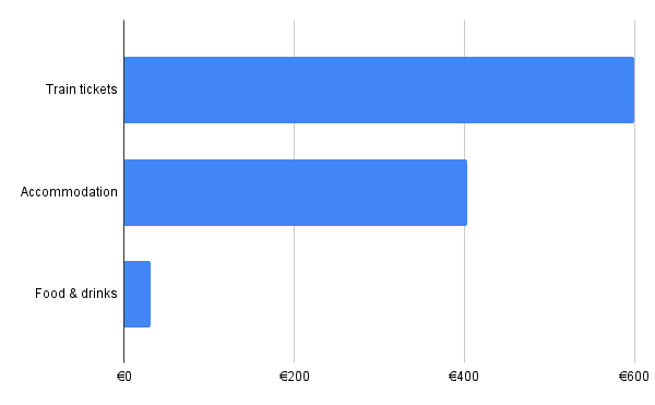
This hike is my come-back to the Pyrenees and to the GR10. The year before I hiked solo from Cauterets to Bagneres de Luchon, while this time, together with Edo, we hiked in another region. We chose this route as we had only a few days to hike and needed a good public transport connection with Toulouse. 

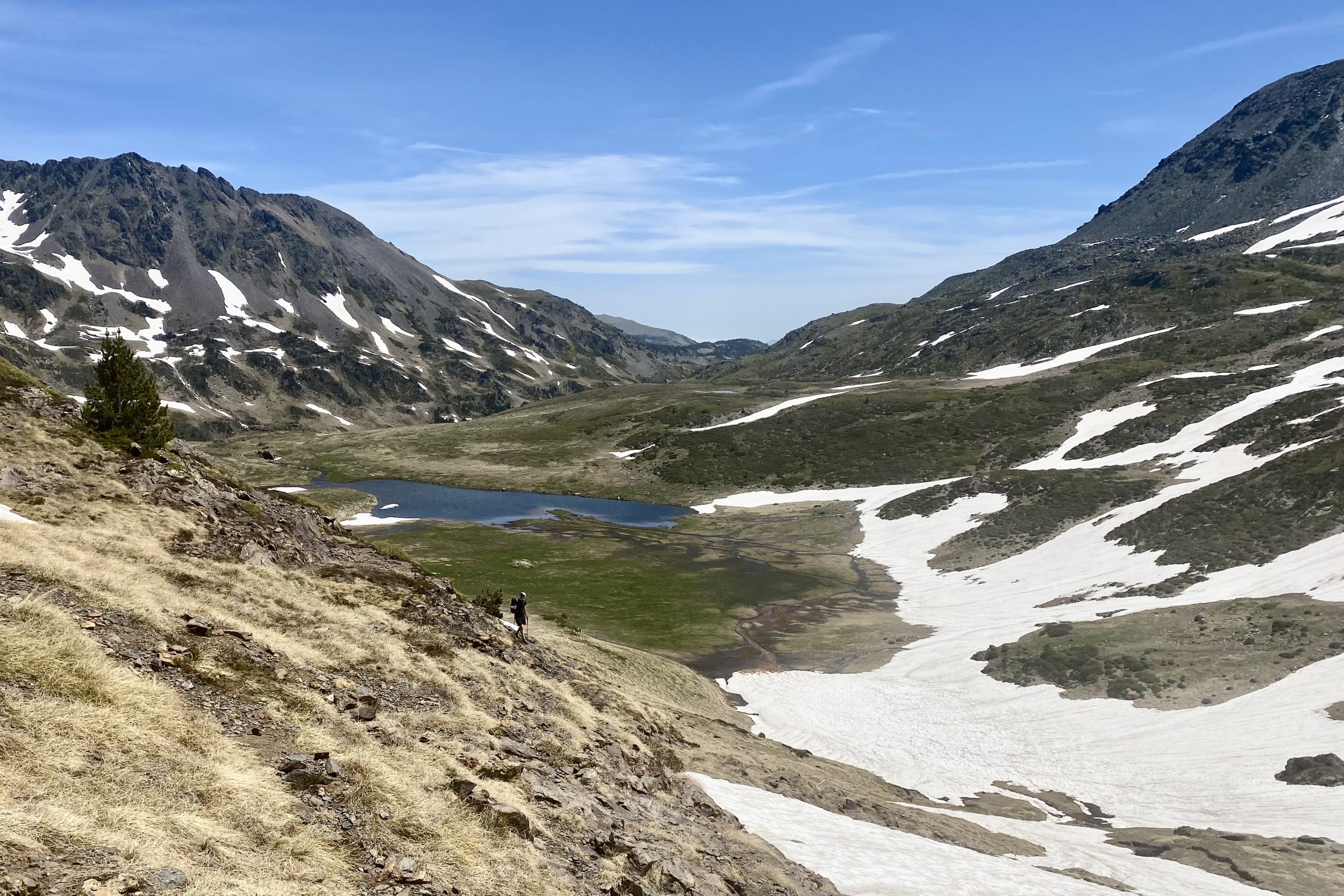
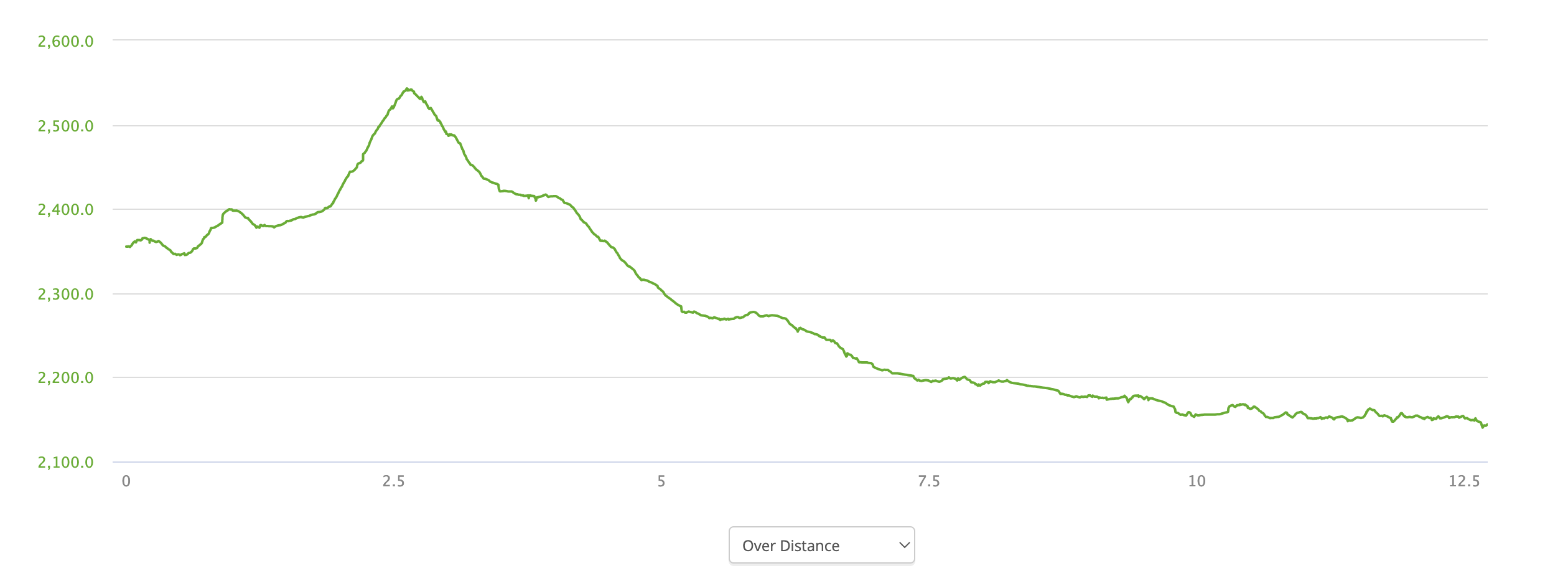
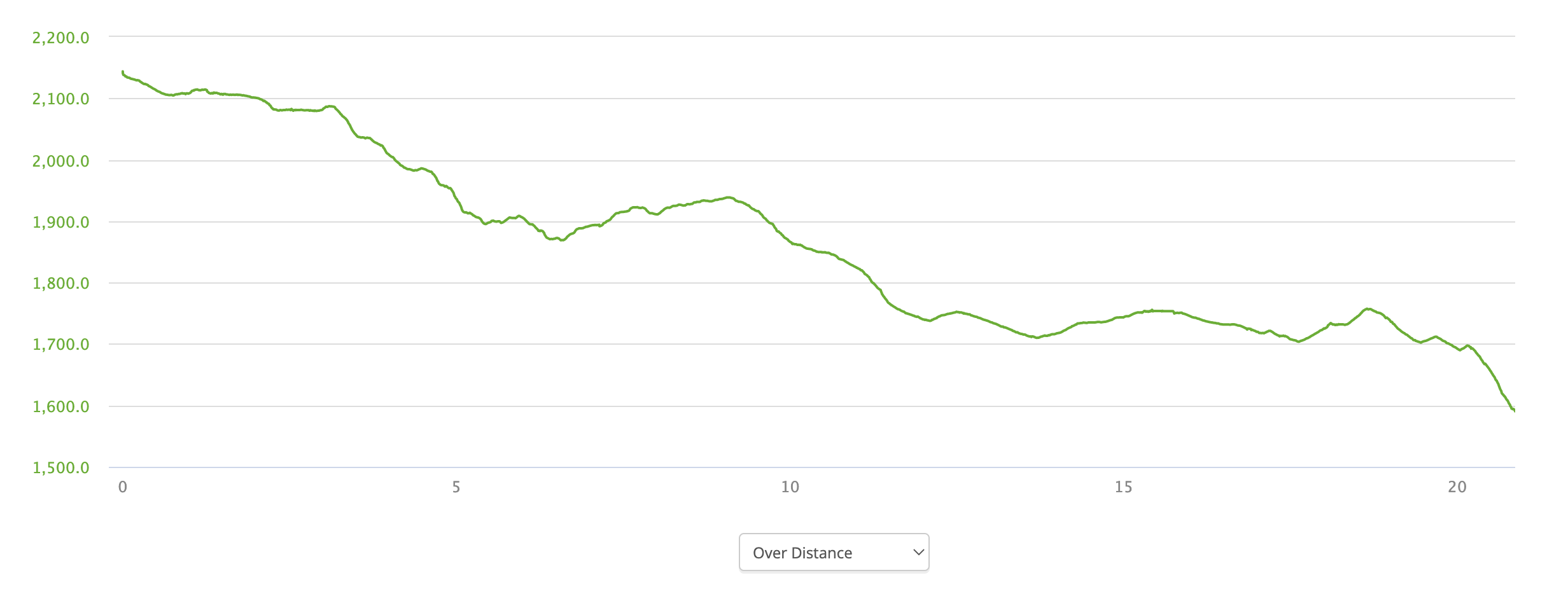
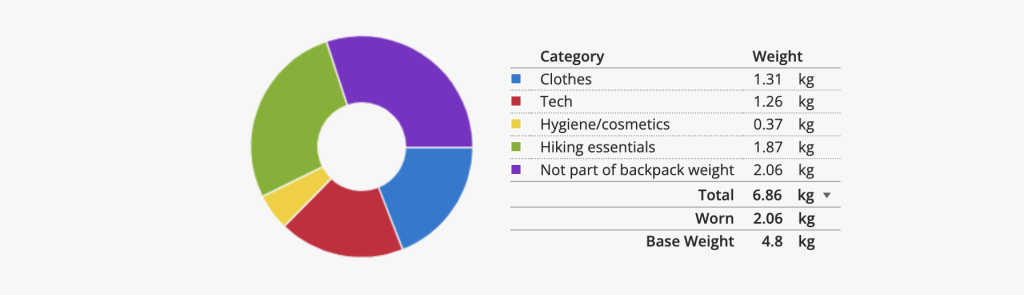
Difficulty: For the Pyrenees you should be in good physical shape. What makes it tough is the steepness of the mountains and the heat. Besides, as we hiked in early June, we came across quite a lot of sections covered in snow. We did not need crampons as hiking sticks provided enough support, but then again, we have some experience of crossing soft snow fields. We met a few hikers who definitely considered those sections challenging, hence I’d rate this trek from moderately difficult to difficult. 

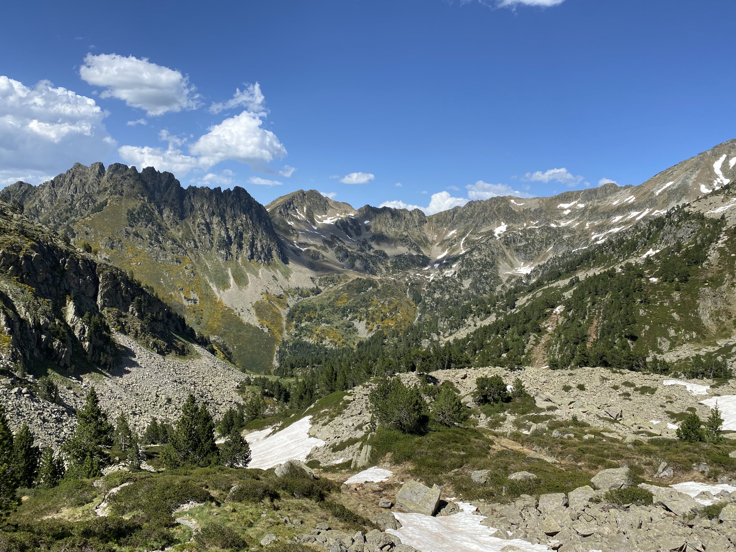
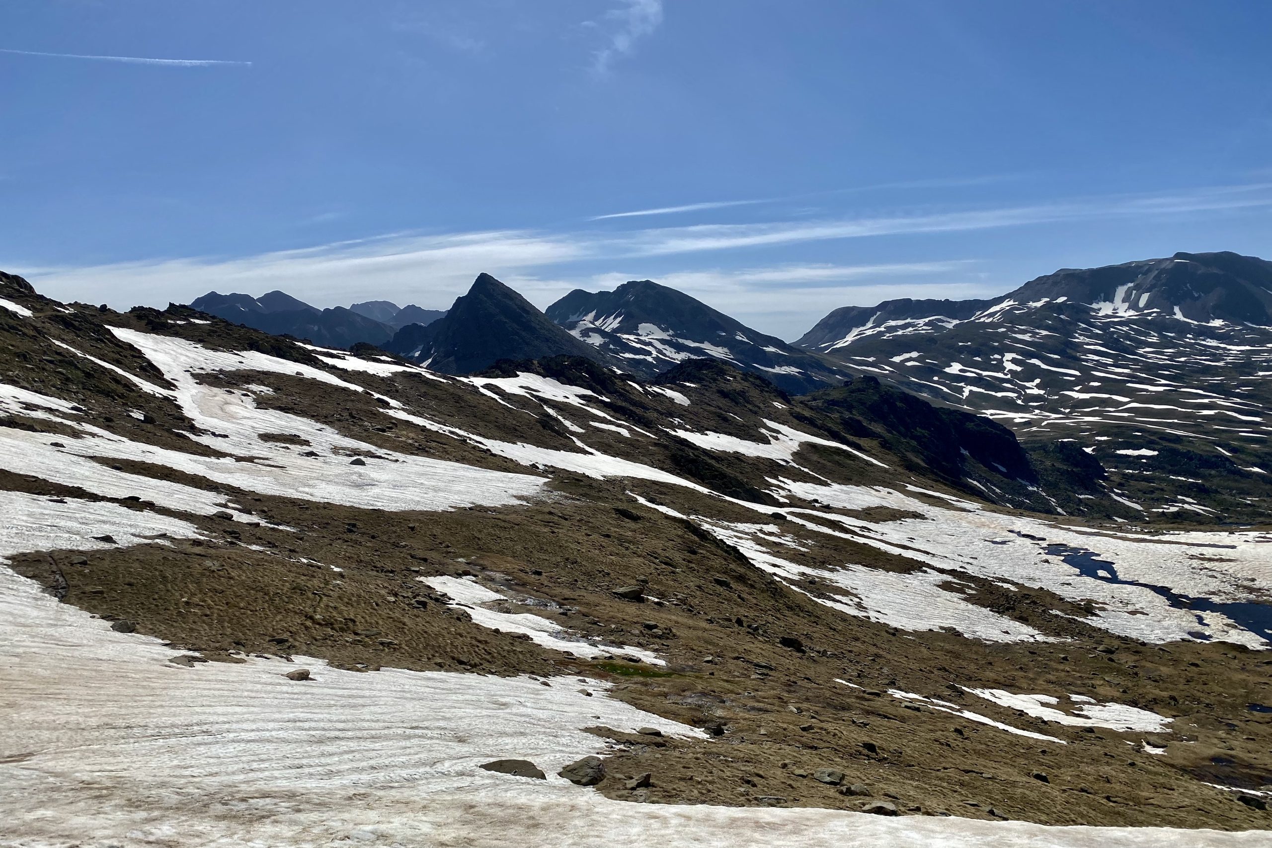
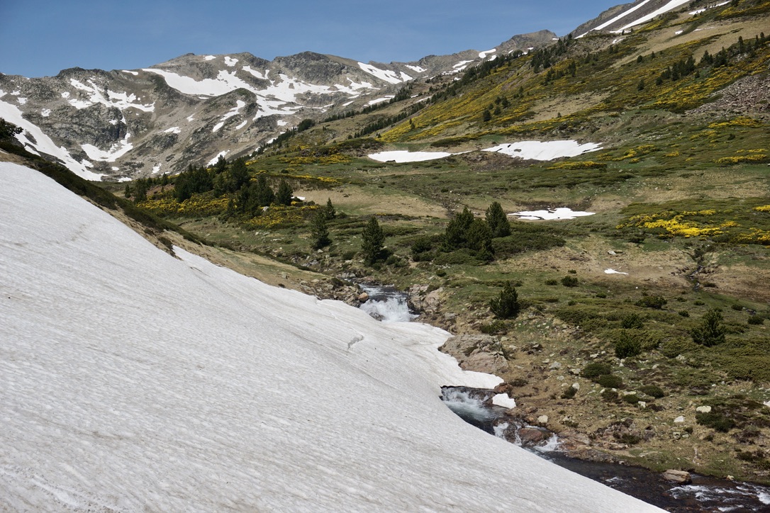
A note on the Pyrenees in early June: we hiked on the 3-5th of June, which is considered early season in the Pyrenees. Some of the mountain huts might still be closed and there will very likely be snow above 2000m. Of course, it all depends on the exact mountain range you’re visiting, its position to the sun, how harsh was the winter, how warm were the weeks before the hike, etc. Anyway, we encountered a lot of snow above 2200m. If you want to avoid snow, July and August would be safer months to hike. 

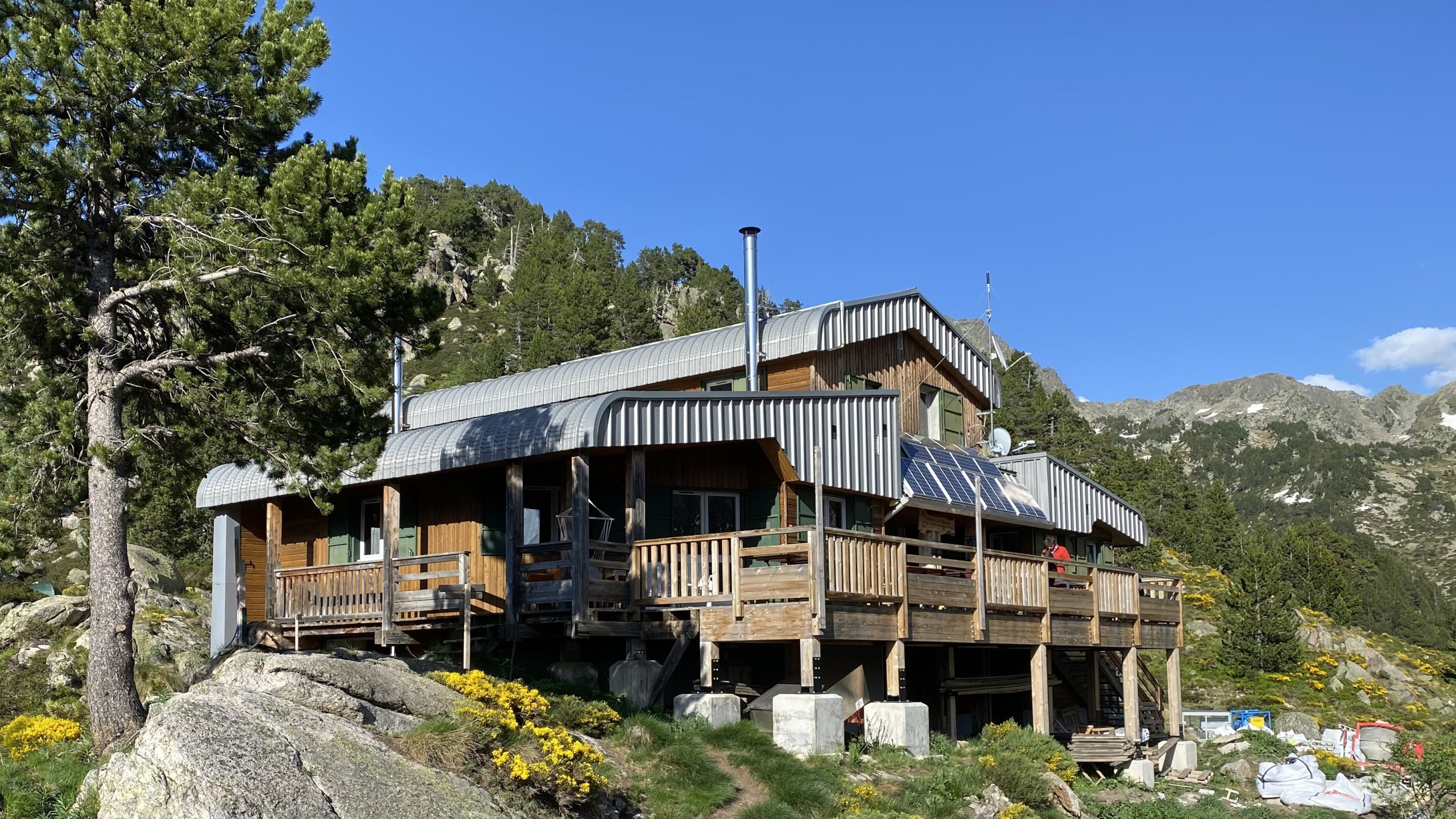
What I liked about hiking in early June, was that there were not that many people on the trail, even in popular places such as Lac des Bouilous. Aaaand, in all of the mountain huts we got the whole room for ourselves since there were only a few people staying overnight. The weather happened to be awesome too and I just loved the fact that I’m back in the mountains so early.

Day 1

Day 2

Day 3

Itinerary & accommodation

Logistics to the start and back: Before the trip, we stayed in Toulouse, which has great train connections to Paris and other major cities in France. From Toulouse there are trains to Merens-les-Vals every 2-3 hours, so we had no problems getting there. If you go by car, check if there’s a place to leave your car for a few days, as Merens-les-Vals is just a small village. Otherwise, consider leaving your car in a town on the train line as that way it’ll be easier to get back.

Although our hike was not circular, we knew that we have to go back to Toulouse since we left our non-hiking luggage there. That’s why we decided to plan the hike in a way that we’re back on the same train line as at the start. The closest stop for us was the Latour-de-Carol train station, it’s also the first stop for the train to Toulouse. From Llo we hiked for an hour to a nearby village called Err, from which we took a bus to Latour-de-Carol. The train ride from Latour-de-Carol to Toulouse takes a bit more than 2.5 hours. 

Our 3-day itinerary:

Day 1: Merens-les-Vals – Refuge des Besines

Day 2: Refuge des Besines – Coll de Coma d’Anyell – Auberge du Carlit

Day 3: Auberge du Carlit – Bolquere – Llo 

Day 1 map
Day 1 elevation profile (in meters)
Refuge des Besines

Day 1: Merens-les-Vals – Refuge des Besines

Distance: 10km

Hiking duration: 3h 00min

Total duration (hiking + rest): 4h 45min 

Total ascent: 1181m

Total descent: 290m

Accommodation: Refuge des Besines

We had a lovely stay at this refuge, thanks to having the whole room to ourselves. Normally each room is quite small and accommodates 8 hikers, so it must be rather tight when in full capacity. The warden is very friendly and makes sure everyone is happy, especially during the dinner, which was very tasty and there was plenty of food for everyone. Breakfast was in a classic modest mountain hut style – bread, jam and cereal. 

It is possible to camp next to the refuge, although I don’t know if you need to pay for it. For our stay we paid 47 Eur per person (half-board) + 3 Eur for a shower. 

Overall impression: It was a tough first day. We started only at 13:00, so the sun was in full power. While the distance was ok for an afternoon hike, the elevation gain was brutal, reminding me once again that the Pyrenees are steep mountains. 

But hey, it was damn beautiful from the start. The valley, covered in all sorts of colours, various streams passing by, a mountain lake – what else can you ask for? Close to Merens-les-Vals there are natural hot springs, which we didn’t visit, but heard a lot of great things from other hikers, so check it out if time permits. 

Day 2 map (second green pointer marks where I accidentally restarted tracking. That's why there are two elevation profile pictures below)
Day 2 elevation profile (first 6km, in meters)
Day 2 elevation profile (remaining 13km, in meters)

Day 2: Refuge des Besines – Coll de Coma d’Anyell – Auberge du Carlit

Distance: 19km 

Hiking duration: 4h 50min

Total duration (hiking + rest): 7h 15min 

Total ascent: 756m

Total descent: 847m

Accommodation: Auberge du Carlit

Once again we got the whole room for ourselves, woohoo! The rooms are spacious, accommodate 6 people and I’d say that overall it is fancier than a typical mountain hut. Everything seems rather new, there’s a kitchen, showers, and toilets to be used by the guests of the Auberge. Dinner was awesome, with giant portions and even several choices for a dessert. For breakfast we also had a bit more choices than in a typical mountain hut, we could even get fancier coffee from a machine (very important!). We also got a lunch package, which was a great value for money. 

I’m not sure if camping next to the Auberge is possible, I didn’t see any tents. For our stay, we paid 62 Eur per person (full-board). 

Overall impression: It was another impressive day in the high mountains. From Refuge des Besines the ascent is rather gentle, the only thing that slowed us down was snow. There was a lot of snow until Lac Lanoux 🙂

Descending both passes of this day required a bit more attention as it was rather steep (and snowy), but hey, all the time we had amazing views. After the second pass (Portella de la Grava), we entered the valley and from there the path was mostly straightforward all the way to Lac des Bouillouses. This is where you’ll meet many day hikers and families. This lake is very popular with visitors and no wonder, it’s a stunning place. 

Day 3 map
Day 3 elevation profile (in meters)
The view from Cal Miquel hotel - that peak is the viewpoint I visited

Day 3: Auberge du Carlit – Bolquere – Llo

Distance: 21km

Hiking duration: 4h 00min

Total duration (hiking + rest): 5h 30min 

Total ascent: 247m

Total descent: 789m

Accommodation: Cal Miquel

What a place! Cal Miquel is a charming little hotel and I loved everything about it. The room was spacious with a roof window through which you can stare at the stars at night. Dinner was of a fancy restaurant quality, with great portions and even free home vine coming with it. Breakfast was also rich in choices and ingredients. The staff (I think it’s a family business) are very attentive and friendly, I felt like I’m staying at relatives instead of a hotel. We had a great night there and if I’m ever in the area, I’m definitely coming back to this place.

For our stay, we paid 57 Eur per person (half-board). 

Overall impression: On day three we said bye bye to the mountains and descended back to the civilization. For the first hour, mountains and lakes kept entertaining us until we reached a wooden path and from there descended to Bolquere. From Bolquere we left GR10, which continues in the east while Llo, our destination for today, sits in the west.

I usually find valley walks a bit boring, but this time it was nice to stare at the big peaks around me while walking on a road (yep, there was quite some road walking). We could see the mountains we came from, the peaks separating France and Spain, and even the peaks of Andorra. At Llo, I also went to a viewpoint (Chapelle Saint-Felix du Chateau) from which the panorama is even more dramatic. Although a walk in a valley, it was a nice ending to this beautiful weekend.

Gear

Even though it was a multi-day hike, our backpacks were rather light as we stayed in mountain refuges or hotels. Staying in mountain huts meant that we need to carry sleeping bags, so I took my multi-day hiking backpack instead of a small one (Osprey Women’s Sirrus 26) to have enough space for everything. Actually, my multi-day backpack (Osprey Eja 48) is lighter than the day pack and I made it even lighter by removing the top part. Anyway, on this hike my base weight was 4.8kg

You can find the full gear list on my LighterPack page, where I store my hiking gear lists from different trips. Here’s a rough summary:

3 items I loved on this trip:

  1. Sun hoodie. Once again I was saved from a burning sun by my lovely Uniqlo sun hoodie. I wore it the whole time and not once did I feel the need to get rid of it. Airy, and protective from the sun, it once again met my expectations.
  2. Towel. This was the first trip where I used this tiny Nabaiji, size S towel for showers, every day. And as Edo forgot his towel, he used mine too. I was impressed by how quickly this towel dries and how well it actually functions. Some of those lightweight microfiber towels serve more as water distributors than towels – you’re still wet after using one, it’s just that the water drops are “distributed” across your body… Nabaiji towel actually dried me, even after being used by Edo 🙂 As for size (I have S), it’s not a towel that allows you to wrap yourself. It does its drying function while being super light (47g).
  3. Hiking sticks. While I take hiking sticks on all the mountain hiking trips anyway, on this one it was irreplaceable as support when hiking through the snow. We didn’t have crampons, but that was not even needed thanks to the hiking sticks, especially on steeper slopes. 


3 items I should have left at home:

  1. Neck gaiter. While usually, this item is super nice to have, this time it was buried deep inside my backpack. While I didn’t use my rain jacket either thanks to super great weather, it served as a “just in case” buffer. As for neck gaiter, I didn’t really need it even if the weather turned rough. I could have survived without it on this trip.
  2. Camera clip. It’s another item that I really like in general, but it just didn’t work on this trip. As my backpack was unusually empty, I put my camera in a side pocket, which allowed me to reach the camera anytime without having to take off the backpack. That way the overall weight balance on my body was less distorted compared to when the camera is hanging on one of the shoulder straps. I might try doing it more often, especially on lightweight trips. 
  3. Sandals. I love having sandals as they allow my feet to rest from hiking shoes at the end of the day and it’s handy to wear them in the public showers. However, as we were hiking for three days only, sandals felt like a luxury item that I could have lived without for such a short trip. Besides, in some of the huts they even offer Crocks to wear inside, thus own “chill” shoes are not needed. 
My gear for this trip

Budget

In total, for this trip (two people) we've spent roughly 1000 Eur.

This time travelling to the Pyrenees was the largest expense item. We travelled by trains all the way from the Netherlands and (sadly) fast trains are expensive.

For accommodation we've spent roughly 50 Eur per person, including dinner and breakfast, so I'd say it's a good value for money. The total accommodation amount here is for 4 nights as we stayed in Toulouse after the hike and only the next day travelled home. Those costs could be reduced even further if you decide to camp and eat your own cooked food.

Food & drinks category mainly comprised of groceries for lunch and a few drinks. Very small part of expenses since we had dinner and breakfast arranged at the accommodation.