

Why this route?
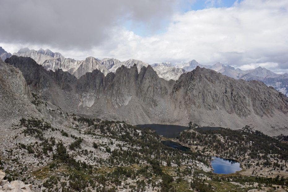
This trail is an amazing alternative in case you cannot do a multi-day hike in the Kings Canyon and you’d like to get a taste of what it has to offer from the east side. Kearsarge Pass borders Kings Canyon and has fantastic views all the way.
How to get there?
As for the most of trails in the USA, the only way to get there is by car. The road to Onion Valley is fun on its own and it usually is open between May and November, depending on the snow conditions. The closest town to the valley is Independence, from which it is roughly a 30min drive up the winding road. Once you get up to the Onion Valley, the trail starts straight from the parking lot.
So how was it?
The trail started with steady zigzags up the hill, while the mountains around us were still heavily covered in clouds. Yesterday the weather was horrible, so we really hoped that today we can make it to the pass dry (dry-ish is also fine). After all, it is a high trail since we are reaching more than 3500m in height.
It did not take long to reach the first lake and there are many of them on the way. A dream trail. While the weather still looked questionable, we proceeded up. The higher we climbed, the rockier the trail got. Soon we were hiking among big boulders and leaving the forest behind.
On our way we met quite a few John Muir Trail (JMT) hikers and chatted with them about the trail. Oh, how I wished to be in their shoes – JMT is on my trail wish list, known for a difficult permit process. Many applications, and a lot fewer spots. Also, something I’m not used to.
It took us roughly two hours to reach the Kearsarge Pass with the last stretch very rocky and exposed. Very doable though. And what a view from the top. Several lakes and the High Sierras around us. I think we’ve spent 45mins sitting at the top, admiring the views and chatting with other hikers.
Overall, it was an amazing day hike, full of expansive views all the way. I also found the trail easy to follow and not technically difficult. The only difficulty is the altitude since the trail starts at roughly 3000m height already. That will dictate the pace to some extent as you might need more breaks to catch your breath. Totally worth it!
| Cookie | Duration | Description |
|---|---|---|
| cookielawinfo-checbox-analytics | 11 months | This cookie is set by GDPR Cookie Consent plugin. The cookie is used to store the user consent for the cookies in the category "Analytics". |
| cookielawinfo-checbox-functional | 11 months | The cookie is set by GDPR cookie consent to record the user consent for the cookies in the category "Functional". |
| cookielawinfo-checbox-others | 11 months | This cookie is set by GDPR Cookie Consent plugin. The cookie is used to store the user consent for the cookies in the category "Other. |
| cookielawinfo-checkbox-necessary | 11 months | This cookie is set by GDPR Cookie Consent plugin. The cookies is used to store the user consent for the cookies in the category "Necessary". |
| cookielawinfo-checkbox-performance | 11 months | This cookie is set by GDPR Cookie Consent plugin. The cookie is used to store the user consent for the cookies in the category "Performance". |
| viewed_cookie_policy | 11 months | The cookie is set by the GDPR Cookie Consent plugin and is used to store whether or not user has consented to the use of cookies. It does not store any personal data. |